Cof Cymru: National Historic Assets of Wales · Wales
Gated Driveway Entrance to Llangollen Railway Station
Llangollen, Denbighshire, Wales
A Grade II listed building in Llangollen, Denbighshire, designated on 22 December 1989.
The record
- Designation
- Listed building, Grade II
- Broad class
- Transport
- Date of designation
- 22 December 1989
- Community
- Llangollen
- Unitary authority
- Denbighshire
- Country
- Wales
- Coordinates
- 52.97140, -3.17029
- Cadw reference
- 1082
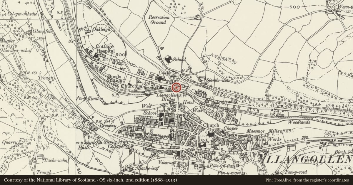
Slide toward Today to fade the historical sheet and see the modern map underneath.
David Rumsey Map Collection, Stanford LibrariesDavid Rumsey Map Collection, Stanford LibrariesDavid Rumsey Map Collection, Stanford LibrariesDavid Rumsey Map Collection, Stanford LibrariesLlyfrgell Genedlaethol Cymru – The National Library of Wales
5 historical maps cover this location, the earliest the 1795 map "To Sir Watkin Williams-Wynn Bart ... the map of the six counties of North Wales is most humbly inscribed by his obedient humble servant" (Llyfrgell Genedlaethol Cymru – The National Library of Wales).
Historical maps covering this location
- 1795 · To Sir Watkin Williams-Wynn Bart ... the map of the six counties of North Wales is most… (Llyfrgell Genedlaethol Cymru – The National Library of Wales)
- 1883 · Watershed map England, Wales 3. (David Rumsey Map Collection, Stanford Libraries)
- 1898 · 121 Wrexham (Hills) (David Rumsey Map Collection, Stanford Libraries)
- 1898 · 121 Wrexham (Outline) (David Rumsey Map Collection, Stanford Libraries)
- 1901 · Sheet 9 and 10. (David Rumsey Map Collection, Stanford Libraries)
Cadw's description
Location
Set back from the NW corner of Llangollen Bridge. At the top of the ramped drive down to the station, at right angles to the road.
History
Probably contemporary with the building of the station in 1865.
Exterior
Broad cast iron gate spans most of the width of the drive, hinged to the right on an iron semi-gate-pier attached to a tall stone gate pier. At the left end there is a small iron pedestrian gate with similar iron semi-pier and attached stone pier; both gates close onto a square iron pier with similar chamfered edges and ball finial. Stone walls border the drive to either side ramping down to left and continuing at Abbey Road level to right - snecked masonry with freestones coping.
The wall terminates to the right at the gable end fronting Abbey Road. The left hand wall may relate to 1898 alterations when the siding by the signal box was added. This continues up to join the bridge at its NW corner.
Reason for designation
Included for group value with Llangollen Station and other related items.
Nearby in the register
- Pillar Box on Pavement outside No.1Communicationsunder 1 mi
- Wedding LimousinesCommercialunder 1 mi
- Welsh CraftsCommercialunder 1 mi
- Bishop TrevorCommercialunder 1 mi
Other entries of the same register within about three miles of this one, by straight line.