Cof Cymru: National Historic Assets of Wales · Wales
Tan-yr-allt
Ciliau Aeron, Ceredigion, Wales
A Grade II listed building in Ciliau Aeron, Ceredigion, designated on 16 February 1986.
The record
- Designation
- Listed building, Grade II
- Broad class
- Domestic
- Date of designation
- 16 February 1986
- Locality
- Ciliau Aeron
- Community
- Ciliau Aeron
- Unitary authority
- Ceredigion
- Country
- Wales
- Coordinates
- 52.20532, -4.17856
- Cadw reference
- 10698
Slide toward Today to fade the historical sheet and see the modern map underneath.
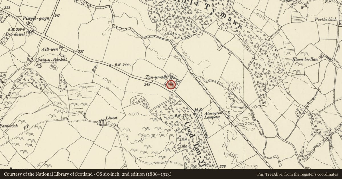
David Rumsey Map Collection, Stanford LibrariesDavid Rumsey Map Collection, Stanford LibrariesDavid Rumsey Map Collection, Stanford LibrariesDavid Rumsey Map Collection, Stanford LibrariesDavid Rumsey Map Collection, Stanford Libraries
5 historical maps cover this location, the earliest the 1608 map "(13) Cambriae Typus." (David Rumsey Map Collection, Stanford Libraries).
Historical maps covering this location
- 1608 · (13) Cambriae Typus. (David Rumsey Map Collection, Stanford Libraries)
- 1830 · V.3:11-15:XV. Britisches Reich. A. Kon: England. b. Frstenthum Wales: Shire: 37-40 (David Rumsey Map Collection, Stanford Libraries)
- 1848 · 57. Tregaron, SW Quad. (David Rumsey Map Collection, Stanford Libraries)
- 1901 · Sheet 14. (David Rumsey Map Collection, Stanford Libraries)
- 1919 · Sheet 78. Lampeter. (David Rumsey Map Collection, Stanford Libraries)
Cadw's description
Location
Situated on N side of A482, approximately 1.3 km E of Ciliau Aeron.
History
Mid C19. Present house not indicated in arrangement of buildings shown on 1844 Tithe map.
Exterior
Rubble construction. Slate roof, projecting bracketed eaves: bargeboards. Rubble gable chimney stacks, also stack to rear left. Three bay front. Pointed windows with stone voussoirs. First floor windows with 9/6-pane horned sash windows: intersecting upper glazing bars. Ground floor with 12/6 horned sash windows: similar glazing. Central pointed doorway with C20 panelled door and 6-pane fanlight having intersecting glazing bars. Bracketed gabled canopy over door with decorative bargeboard.
Blank whitewashed right end. Left end with C20 window to contemporary rear outshut: stone voussoirs. Whitewashed rear with large central projecting gabled porch, round arched doorway with stone voussoirs: C20 door and plain fanlight. C20 windows. Porch extends to rear whitewashed rubble court wall.
Reason for designation
Mid C19 farmhouse in the late Gothick style of this area.
Nearby in the register
- Milestone near Tan-yr-alltTransportunder 1 mi
- Pont NewyddTransportunder 1 mi
- Ty MawrDomesticunder 1 mi
- Entrance Gates to Ty MawrDomesticunder 1 mi
Other entries of the same register within about three miles of this one, by straight line.