Cof Cymru: National Historic Assets of Wales · Wales
Capel Carmel
Llandysul, Ceredigion, Wales
A Grade II listed building in Prengwyn, Llandysul, Ceredigion, designated on 13 January 1993.
The record
- Designation
- Listed building, Grade II
- Broad class
- Religious, Ritual and Funerary
- Date of designation
- 13 January 1993
- Locality
- Prengwyn
- Community
- Llandysul
- Unitary authority
- Ceredigion
- Country
- Wales
- Coordinates
- 52.07635, -4.29767
- Cadw reference
- 10640
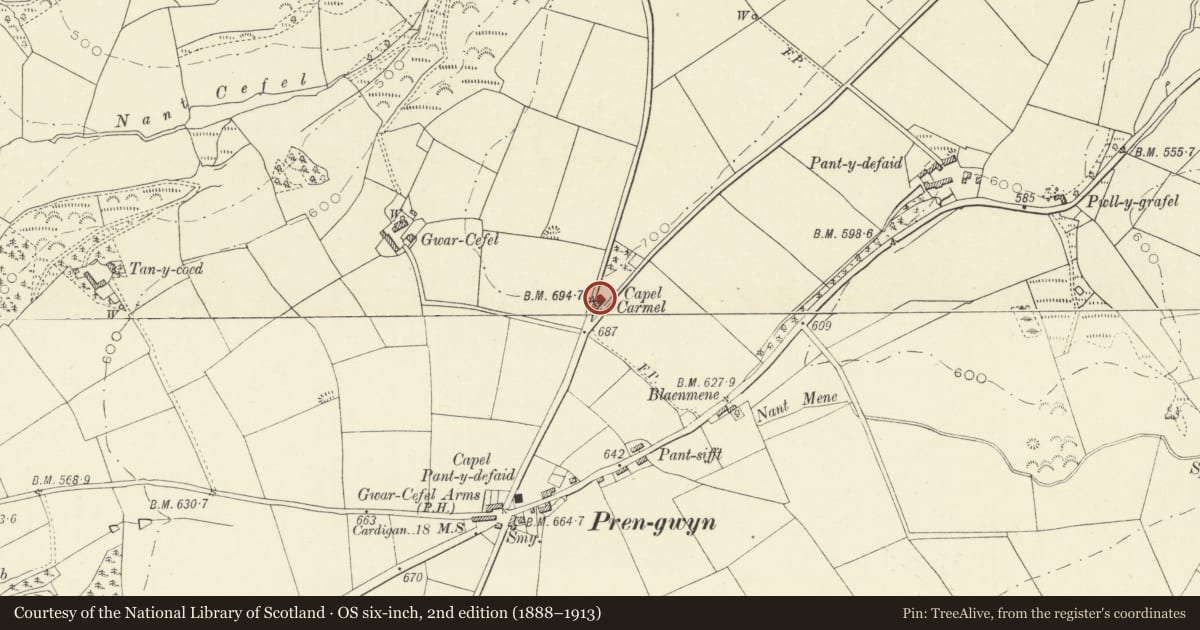
Slide toward Today to fade the historical sheet and see the modern map underneath.
David Rumsey Map Collection, Stanford LibrariesDavid Rumsey Map Collection, Stanford LibrariesDavid Rumsey Map Collection, Stanford LibrariesDavid Rumsey Map Collection, Stanford LibrariesDavid Rumsey Map Collection, Stanford Libraries
5 historical maps cover this location, the earliest the 1608 map "(13) Cambriae Typus." (David Rumsey Map Collection, Stanford Libraries).
Historical maps covering this location
- 1608 · (13) Cambriae Typus. (David Rumsey Map Collection, Stanford Libraries)
- 1830 · V.3:11-15:XV. Britisches Reich. A. Kon: England. b. Frstenthum Wales: Shire: 37-40 (David Rumsey Map Collection, Stanford Libraries)
- 1899 · 194 Llangranog (Hills) (David Rumsey Map Collection, Stanford Libraries)
- 1901 · Sheet 14. (David Rumsey Map Collection, Stanford Libraries)
- 1919 · Sheet 78. Lampeter. (David Rumsey Map Collection, Stanford Libraries)
Cadw's description
Location
Situated in angle between lanes to Pontsian and Maesymeillion some 300m N of Prengwyn.
History
1832
Exterior
Calvinistic Methodist chapel in unpainted stucco with slate roof. Lateral facade with 2 broad arched windows to centre with glazing bars and radiating bars to heads, 2 small rectangular 6-pane gallery windows and 2 outer arched doorways, ledged to doors with radiating bar fanlights. Plaque 'A adeiladwyd gan Mr Jones o Bantyfefaid 1819 Ailadeiladwyd 1832'. Shallow eaves with paired brackets.
Raised stucco surrounds, angle strips and string course at impost level of main windows.
Interior
Interior has later C19 gallery, curved at angles with pierced cast-iron front on 2 x 3 cast iron columns. Grained painted pews and pulpit appear to date from a renewal in 1865.
Nearby in the register
- Capel PantdefaidReligious, Ritual and Funeraryunder 1 mi
- Milestone to W of Crossroads at PrengwynTransportunder 1 mi
- Outbuilding on N side of farmyard of PantydefaidAgriculture and Subsistenceunder 1 mi
- Cwm MarchDomesticunder 1 mi
Other entries of the same register within about three miles of this one, by straight line.