Cof Cymru: National Historic Assets of Wales · Wales
Cwm March
Llandysul, Ceredigion, Wales
A Grade II listed building in Prengwyn, Llandysul, Ceredigion, designated on 13 January 1993.
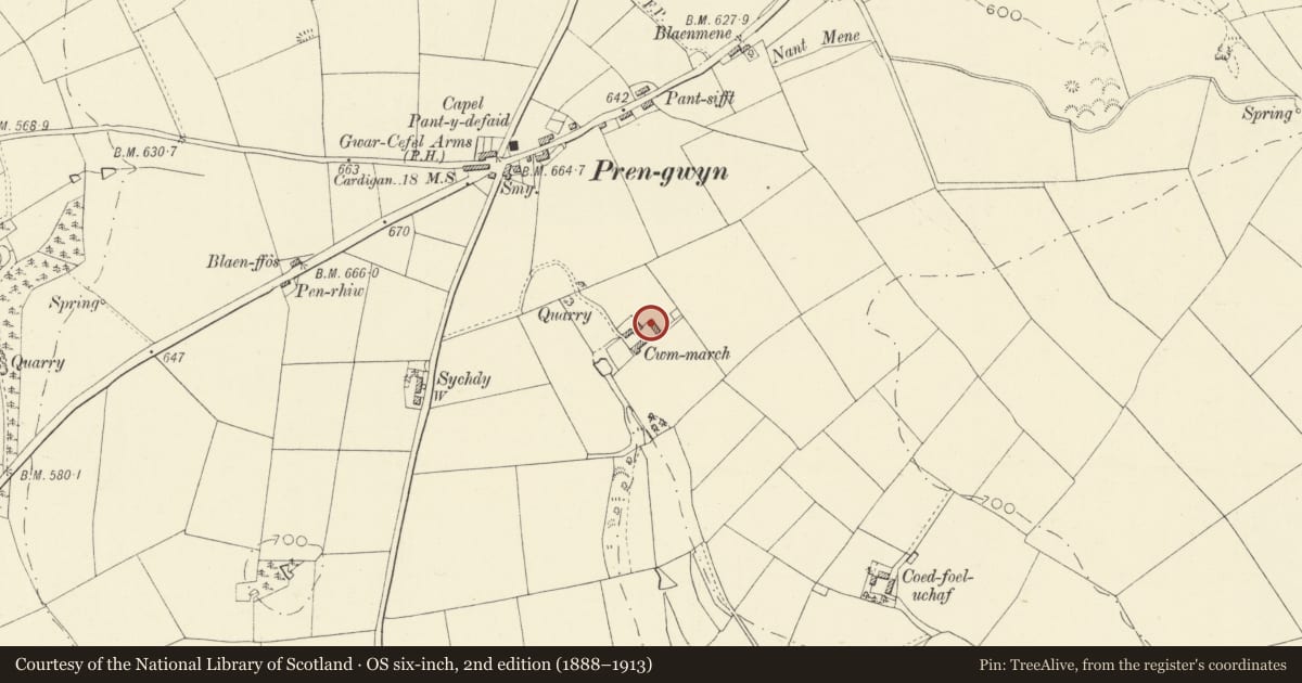
The record
- Designation
- Listed building, Grade II
- Broad class
- Domestic
- Date of designation
- 13 January 1993
- Locality
- Prengwyn
- Community
- Llandysul
- Unitary authority
- Ceredigion
- Country
- Wales
- Coordinates
- 52.07156, -4.29670
- Cadw reference
- 10630
Slide toward Today to fade the historical sheet and see the modern map underneath.
David Rumsey Map Collection, Stanford LibrariesDavid Rumsey Map Collection, Stanford LibrariesDavid Rumsey Map Collection, Stanford LibrariesDavid Rumsey Map Collection, Stanford LibrariesDavid Rumsey Map Collection, Stanford Libraries
5 historical maps cover this location, the earliest the 1830 map "V.3:11-15:XV. Britisches Reich. A. Kon: England. b. Frstenthum Wales: Shire: 37-40" (David Rumsey Map Collection, Stanford Libraries).
Historical maps covering this location
- 1830 · V.3:11-15:XV. Britisches Reich. A. Kon: England. b. Frstenthum Wales: Shire: 37-40 (David Rumsey Map Collection, Stanford Libraries)
- 1860 · 41. Caermathen. (David Rumsey Map Collection, Stanford Libraries)
- 1899 · 194 Llangranog (Hills) (David Rumsey Map Collection, Stanford Libraries)
- 1901 · Sheet 14. (David Rumsey Map Collection, Stanford Libraries)
- 1919 · Sheet 78. Lampeter. (David Rumsey Map Collection, Stanford Libraries)
Cadw's description
Location
Situated down long curving farm track beginning some 300m S of Prengwyn crossroads.
History
Dated 1873 John Thomas
Exterior
Farmhouse in whitewashed rubble stone with slate roofs and stone stacks. Two-storey 3-window house with big 12-pane sashes, stone voussoirs and slate sills. Centre door with similar voussoirs, ledged door and overlight. Rubble stone enclosing wall to front garden with slate coping and bent wire railings with matching gate.
Big service range to right, lower with stone ridge stack and brick end stack, 2 parts without any division in stonework, each with door to left, 12-pane sash to right and small 4-pane window above under eaves.
Reason for designation
A late but unaltered example of traditional farmhouse with all original windows surviving.
Deteriorating condition.
Nearby in the register
- Capel PantdefaidReligious, Ritual and Funeraryunder 1 mi
- Milestone to W of Crossroads at PrengwynTransportunder 1 mi
- Outbuilding on W side of farmcourt at Coedfoel UchafAgriculture and Subsistenceunder 1 mi
- Coedfoel UchafDomesticunder 1 mi
Other entries of the same register within about three miles of this one, by straight line.