Cof Cymru: National Historic Assets of Wales · Wales
Pantydefaid including Lower Range to Right
Llandysul, Ceredigion, Wales
A Grade II listed building in Prengwyn, Llandysul, Ceredigion, designated on 13 January 1993.
The record
- Designation
- Listed building, Grade II
- Broad class
- Domestic
- Date of designation
- 13 January 1993
- Locality
- Prengwyn
- Community
- Llandysul
- Unitary authority
- Ceredigion
- Country
- Wales
- Coordinates
- 52.07818, -4.29020
- Cadw reference
- 10628
Slide toward Today to fade the historical sheet and see the modern map underneath.
David Rumsey Map Collection, Stanford LibrariesDavid Rumsey Map Collection, Stanford LibrariesDavid Rumsey Map Collection, Stanford LibrariesDavid Rumsey Map Collection, Stanford LibrariesDavid Rumsey Map Collection, Stanford Libraries
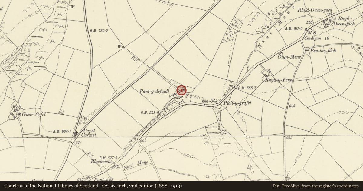
5 historical maps cover this location, the earliest the 1608 map "(13) Cambriae Typus." (David Rumsey Map Collection, Stanford Libraries).
Historical maps covering this location
- 1608 · (13) Cambriae Typus. (David Rumsey Map Collection, Stanford Libraries)
- 1830 · V.3:11-15:XV. Britisches Reich. A. Kon: England. b. Frstenthum Wales: Shire: 37-40 (David Rumsey Map Collection, Stanford Libraries)
- 1899 · 194 Llangranog (Hills) (David Rumsey Map Collection, Stanford Libraries)
- 1901 · Sheet 14. (David Rumsey Map Collection, Stanford Libraries)
- 1919 · Sheet 78. Lampeter. (David Rumsey Map Collection, Stanford Libraries)
Cadw's description
Location
Situated set back in farmyard some 750m E of Prengwyn.
History
Dated 1700 but possibly of later C18 date.
Exterior
Farmhouse, rendered under creeper with big rendered end stacks and slate roof. Two-and-a-half storeys, 3-window range of renewed 4-pane sashes and 3 gabled dormers also with 4-pane sashes. Centre C19 6-panel door with overlight. Stone voussoirs above are left exposed and each has single letter 'JOHN JONES 1700'.
To right is lower rubble 2-window service range, C19, with brick door and window heads and brick E end stack. Small 12-pane sashes above, door and renewed 4-pane sash below.
Main house has NE rendered rear wing, later C19 with yellow brick stack, centre stair gable, possibly C18, rubble with C19 4-pane sash and yellow brick head and outshut to left.
Interior
Interior not inspected.
Reason for designation
Listed as the earliest dated house in the area, owned by Jones family to later C19.
Nearby in the register
- Outbuilding on N side of farmyard of PantydefaidAgriculture and Subsistenceunder 1 mi
- Capel CarmelReligious, Ritual and Funeraryunder 1 mi
- Milestone W of RhydowenfachTransportunder 1 mi
- Capel PantdefaidReligious, Ritual and Funeraryunder 1 mi
Other entries of the same register within about three miles of this one, by straight line.