Cof Cymru: National Historic Assets of Wales · Wales
Gatepiers & Gates to S of Llanfair
Llandysul, Ceredigion, Wales
A Grade II listed building in Llanfair, Llandysul, Ceredigion, designated on 13 January 1993.
The record
- Designation
- Listed building, Grade II
- Broad class
- Domestic
- Date of designation
- 13 January 1993
- Locality
- Llanfair
- Community
- Llandysul
- Unitary authority
- Ceredigion
- Country
- Wales
- Coordinates
- 52.04391, -4.28589
- Cadw reference
- 10609
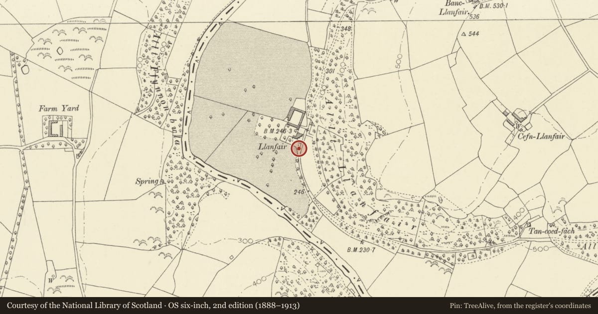
Slide toward Today to fade the historical sheet and see the modern map underneath.
David Rumsey Map Collection, Stanford LibrariesDavid Rumsey Map Collection, Stanford LibrariesDavid Rumsey Map Collection, Stanford LibrariesDavid Rumsey Map Collection, Stanford LibrariesDavid Rumsey Map Collection, Stanford Libraries
5 historical maps cover this location, the earliest the 1830 map "V.3:11-15:XV. Britisches Reich. A. Kon: England. b. Frstenthum Wales: Shire: 37-40" (David Rumsey Map Collection, Stanford Libraries).
Historical maps covering this location
- 1830 · V.3:11-15:XV. Britisches Reich. A. Kon: England. b. Frstenthum Wales: Shire: 37-40 (David Rumsey Map Collection, Stanford Libraries)
- 1860 · 41. Caermathen. (David Rumsey Map Collection, Stanford Libraries)
- 1891 · Sheet 10. Ordnance Survey of England and Wales. . (David Rumsey Map Collection, Stanford Libraries)
- 1899 · 194 Llangranog (Hills) (David Rumsey Map Collection, Stanford Libraries)
- 1901 · Sheet 14. (David Rumsey Map Collection, Stanford Libraries)
Cadw's description
Location
Situated on main entry to Llanfair from lane some 50m S of house.
History
Mid C19
Exterior
Pair of ashlar gatepiers with ogee caps and finials. Two wrought iron gates with dog-bars, scrolled mid-rails and top-rails curved with scrolled spearheads, urns on hinge post and scrolled work on taller inner upright.
There is matching but eroded ironwork on 2 sides of the front forecourt to the house.
Reason for designation
Group value with the house.
Nearby in the register
- Llanfair including attached W Range.Domesticunder 1 mi
- One of Four Linked Outbuildings forming Courtyard at LlanfairDomesticunder 1 mi
- One of Four Linked Outbuildings forming Courtyard at LlanfairDomesticunder 1 mi
- One of Four Linked Outbuildings forming Courtyard at LlanfairDomesticunder 1 mi
Other entries of the same register within about three miles of this one, by straight line.