Cof Cymru: National Historic Assets of Wales · Wales
Stable Range at Gilfachwen-isaf
Llandysul, Ceredigion, Wales
A Grade II listed building in Gilfachwen, Llandysul, Ceredigion, designated on 13 January 1993.
The record
- Designation
- Listed building, Grade II
- Broad class
- Domestic
- Date of designation
- 13 January 1993
- Locality
- Gilfachwen
- Community
- Llandysul
- Unitary authority
- Ceredigion
- Country
- Wales
- Coordinates
- 52.04189, -4.32948
- Cadw reference
- 10601
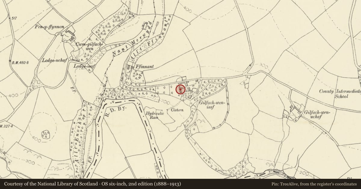
Slide toward Today to fade the historical sheet and see the modern map underneath.
David Rumsey Map Collection, Stanford LibrariesDavid Rumsey Map Collection, Stanford LibrariesDavid Rumsey Map Collection, Stanford LibrariesDavid Rumsey Map Collection, Stanford LibrariesDavid Rumsey Map Collection, Stanford Libraries
5 historical maps cover this location, the earliest the 1830 map "V.3:11-15:XV. Britisches Reich. A. Kon: England. b. Frstenthum Wales: Shire: 37-40" (David Rumsey Map Collection, Stanford Libraries).
Historical maps covering this location
- 1830 · V.3:11-15:XV. Britisches Reich. A. Kon: England. b. Frstenthum Wales: Shire: 37-40 (David Rumsey Map Collection, Stanford Libraries)
- 1860 · 41. Caermathen. (David Rumsey Map Collection, Stanford Libraries)
- 1891 · Sheet 10. Ordnance Survey of England and Wales. . (David Rumsey Map Collection, Stanford Libraries)
- 1898 · 211 Newcastle Emlyn (Hills) (David Rumsey Map Collection, Stanford Libraries)
- 1901 · Sheet 14. (David Rumsey Map Collection, Stanford Libraries)
Cadw's description
Location
Situated to W of Gilfachwen Isaf farmhouse.
History
Early C19.
Exterior
Lofted stable, formerly part of Plas Gilfachwen, now with former estate farmhouse. Blue lias coursed rubble with slate roofs. Formal 2-storey 3-window stable block with big centre round-arched entry, window each side and 3 similar above, all near square with blue lias voussoirs and keystones, mostly boarded in. Centre entry gives access to stable each side, while loft has access from rear outside steps. 7-bay roof with wishbone collar trusses. Single storey outbuilding to left with window door and window, similar voussoirs and keystones. 3-bay pegged collar truss roof on projecting wall piers.
Reason for designation
A good formal estate building, built for Lloyds of Gilfachwen and the least altered of the country house group at Gilfachwen.
Nearby in the register
- CaerglynDomesticunder 1 mi
- Bridge StreetDomesticunder 1 mi
- Llandysul Bridge (partly in Llanfihangel-ar Arth community, Carmarthenshire)Transportunder 1 mi
- 1 Bridge StreetDomesticunder 1 mi
Other entries of the same register within about three miles of this one, by straight line.