Cof Cymru: National Historic Assets of Wales · Wales
1 Bridge Street
Llandysul, Ceredigion, Wales
A Grade II listed building in Llandysul, Ceredigion, designated on 13 January 1993.
The record
- Designation
- Listed building, Grade II
- Broad class
- Domestic
- Date of designation
- 13 January 1993
- Community
- Llandysul
- Unitary authority
- Ceredigion
- Country
- Wales
- Coordinates
- 52.03876, -4.31235
- Cadw reference
- 10566
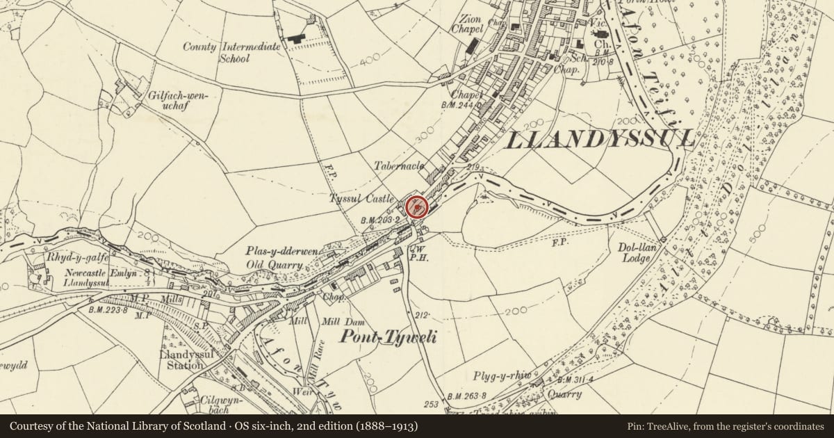
Slide toward Today to fade the historical sheet and see the modern map underneath.
David Rumsey Map Collection, Stanford LibrariesDavid Rumsey Map Collection, Stanford LibrariesDavid Rumsey Map Collection, Stanford LibrariesDavid Rumsey Map Collection, Stanford LibrariesDavid Rumsey Map Collection, Stanford Libraries
5 historical maps cover this location, the earliest the 1830 map "V.3:11-15:XV. Britisches Reich. A. Kon: England. b. Frstenthum Wales: Shire: 37-40" (David Rumsey Map Collection, Stanford Libraries).
Historical maps covering this location
- 1830 · V.3:11-15:XV. Britisches Reich. A. Kon: England. b. Frstenthum Wales: Shire: 37-40 (David Rumsey Map Collection, Stanford Libraries)
- 1860 · 41. Caermathen. (David Rumsey Map Collection, Stanford Libraries)
- 1891 · Sheet 10. Ordnance Survey of England and Wales. . (David Rumsey Map Collection, Stanford Libraries)
- 1898 · 211 Newcastle Emlyn (Hills) (David Rumsey Map Collection, Stanford Libraries)
- 1901 · Sheet 14. (David Rumsey Map Collection, Stanford Libraries)
Cadw's description
Location
Situated at W end of street, by Llandysul Bridge.
History
Early C19
Exterior
House in coursed rubble stone with slate roof and stone end stacks. Two-storey 3-window range of well-spaced sashes, 9-pane above, 12-pane below and centre door. Stone voussoirs to cambered heads and slate sills. 6-panel door with traceried overlight. Flat eaves with paired brackets.
No 1, attached to E, has similar bracketted eaves, but single large and later C19 shopfront. Centre door between 2 big 3-light shop-windows, the lights with Tudor-arched heads, piers each side of shop-windows carrying brackets to overall shelf hood, and double doors with overlight. Outshut rear and rear wing with 12-pane sash.
Reason for designation
One of the best surviving houses in the town, late Georgian in style, important on approach to bridge.
Nearby in the register
- Bridge StreetDomesticunder 1 mi
- CaerglynDomesticunder 1 mi
- Llandysul Bridge (partly in Llanfihangel-ar Arth community, Carmarthenshire)Transportunder 1 mi
- Pont Llandysul (Partly in Llandysul Community)Transportunder 1 mi
Other entries of the same register within about three miles of this one, by straight line.