Cof Cymru: National Historic Assets of Wales · Wales
The Old School
St. Dogmaels, Pembrokeshire, Wales
A Grade II listed building in St Dogmaels, Pembrokeshire, designated on 14 April 1992.
The record
- Designation
- Listed building, Grade II
- Broad class
- Education
- Date of designation
- 14 April 1992
- Locality
- St Dogmaels
- Community
- St. Dogmaels
- Unitary authority
- Pembrokeshire
- Country
- Wales
- Coordinates
- 52.08015, -4.67848
- Cadw reference
- 10554
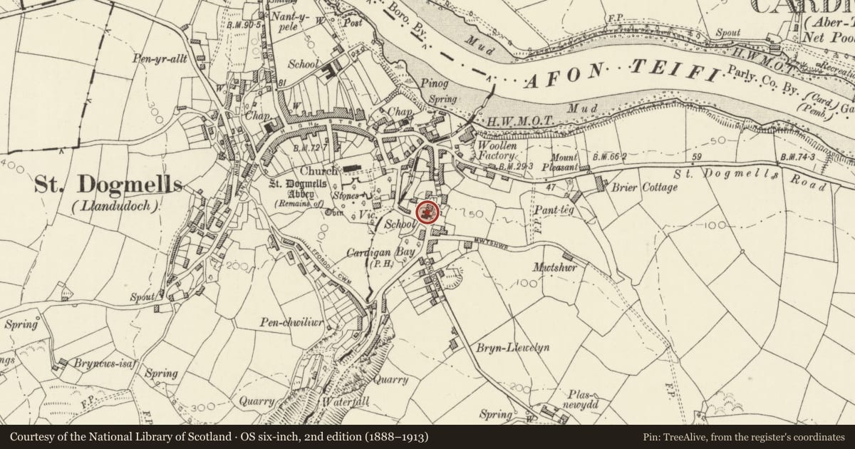
Slide toward Today to fade the historical sheet and see the modern map underneath.
David Rumsey Map Collection, Stanford LibrariesDavid Rumsey Map Collection, Stanford LibrariesDavid Rumsey Map Collection, Stanford LibrariesDavid Rumsey Map Collection, Stanford LibrariesDavid Rumsey Map Collection, Stanford Libraries
5 historical maps cover this location, the earliest the 1608 map "(13) Cambriae Typus." (David Rumsey Map Collection, Stanford Libraries).
Historical maps covering this location
- 1608 · (13) Cambriae Typus. (David Rumsey Map Collection, Stanford Libraries)
- 1637 · Particular description of Wales. Cambria seu Wallia (David Rumsey Map Collection, Stanford Libraries)
- 1830 · V.3:11-15:XV. Britisches Reich. A. Kon: England. b. Frstenthum Wales: Shire: 37-40 (David Rumsey Map Collection, Stanford Libraries)
- 1898 · 193 Cardigan (Hills) (David Rumsey Map Collection, Stanford Libraries)
- 1901 · Sheet 13. (David Rumsey Map Collection, Stanford Libraries)
Cadw's description
Location
Situated on corner of Shingrig and David Street.
History
Early C19 chapel converted to school in later C19.
Exterior
Rubble stone with slate roof. Single storey 2-room school with 2 low single storey wings projecting to west. East side has 2 early C19 12-pane sashes with cambered stone heads and slate sills. North and south end walls have late C19 tall schoolroom windows, grouped triplet with cambered painted heads and slate sills. On west side is central original window with pointed head, intersecting glazing bars, and painted stone voussoirs. Low wing to left has west end casement pair, wing to right has west end bellcote and triple casement in painted stucco surround. Two tall red brick stacks were removed 1991, from main building.
School and Old School Cottage are in large courtyard with rubble stone wall around. Iron double gates to south and single gate to west.
Reason for designation
Prominent public building which is included for importance in view east from Abbey grounds.
Nearby in the register
- Old School CottageDomesticunder 1 mi
- The Vicarage StablesDomesticunder 1 mi
- Wall attached to rear of Vicarage stables and running to N of VicarageDomesticunder 1 mi
- The VicarageDomesticunder 1 mi
Other entries of the same register within about three miles of this one, by straight line.