Cof Cymru: National Historic Assets of Wales · Wales
The Vicarage Stables
St. Dogmaels, Pembrokeshire, Wales
A Grade II listed building in Shinrig, St. Dogmaels, Pembrokeshire, designated on 15 November 1993.
The record
- Designation
- Listed building, Grade II
- Broad class
- Domestic
- Date of designation
- 15 November 1993
- Locality
- Shinrig
- Community
- St. Dogmaels
- Unitary authority
- Pembrokeshire
- Country
- Wales
- Coordinates
- 52.08054, -4.67940
- Cadw reference
- 13103
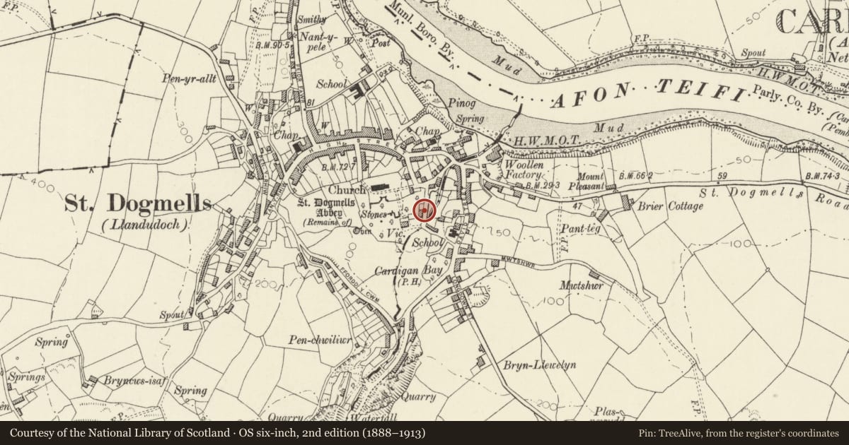
Slide toward Today to fade the historical sheet and see the modern map underneath.
David Rumsey Map Collection, Stanford LibrariesDavid Rumsey Map Collection, Stanford LibrariesDavid Rumsey Map Collection, Stanford LibrariesDavid Rumsey Map Collection, Stanford LibrariesDavid Rumsey Map Collection, Stanford Libraries
5 historical maps cover this location, the earliest the 1608 map "(13) Cambriae Typus." (David Rumsey Map Collection, Stanford Libraries).
Historical maps covering this location
- 1608 · (13) Cambriae Typus. (David Rumsey Map Collection, Stanford Libraries)
- 1637 · Particular description of Wales. Cambria seu Wallia (David Rumsey Map Collection, Stanford Libraries)
- 1830 · V.3:11-15:XV. Britisches Reich. A. Kon: England. b. Frstenthum Wales: Shire: 37-40 (David Rumsey Map Collection, Stanford Libraries)
- 1898 · 193 Cardigan (Hills) (David Rumsey Map Collection, Stanford Libraries)
- 1901 · Sheet 13. (David Rumsey Map Collection, Stanford Libraries)
Cadw's description
Location
Situated SE of abbey ruins, N of drive to vicarage.
Exterior
Mid C19 coach house and stable in brown squared rubble stone with slate roof, ridge vent and cement coping. Two-storey three-window range. Projecting gabled centre, with broad arched carriage-entry with double ledged doors, and large roundel in gable, flush sandstone ashlar arch head and surround to roundel. Each side, stable door with window above, cambered heads, sandstone ashlar flush voussoirs and slate sills. South end wall has similar gable roundel and ground floor arched window with fanlight. North end has loft door with arched head and ground floor door. Rear has door to left, four small vent loops, centre door and window. Two rows of dove holes above centre door and loft window each side.
Restored in 1992-93 by Cadw for use in association with the abbey ruins.
Reason for designation
Group value with abbey ruins and adjoining listed structures.
Nearby in the register
- Wall attached to rear of Vicarage stables and running to N of VicarageDomesticunder 1 mi
- The VicarageDomesticunder 1 mi
- Wall along S side of ChurchyardReligious, Ritual and Funeraryunder 1 mi
- Former Bier House beside steps to LychgateDomesticunder 1 mi
Other entries of the same register within about three miles of this one, by straight line.