Cof Cymru: National Historic Assets of Wales · Wales
26 Quay Street
Cardigan, Ceredigion, Wales
A Grade II listed building in Cardigan, Ceredigion, designated on 14 April 1992.
The record
- Designation
- Listed building, Grade II
- Broad class
- Domestic
- Date of designation
- 14 April 1992
- Community
- Cardigan
- Unitary authority
- Ceredigion
- Country
- Wales
- Coordinates
- 52.08190, -4.66147
- Cadw reference
- 10523
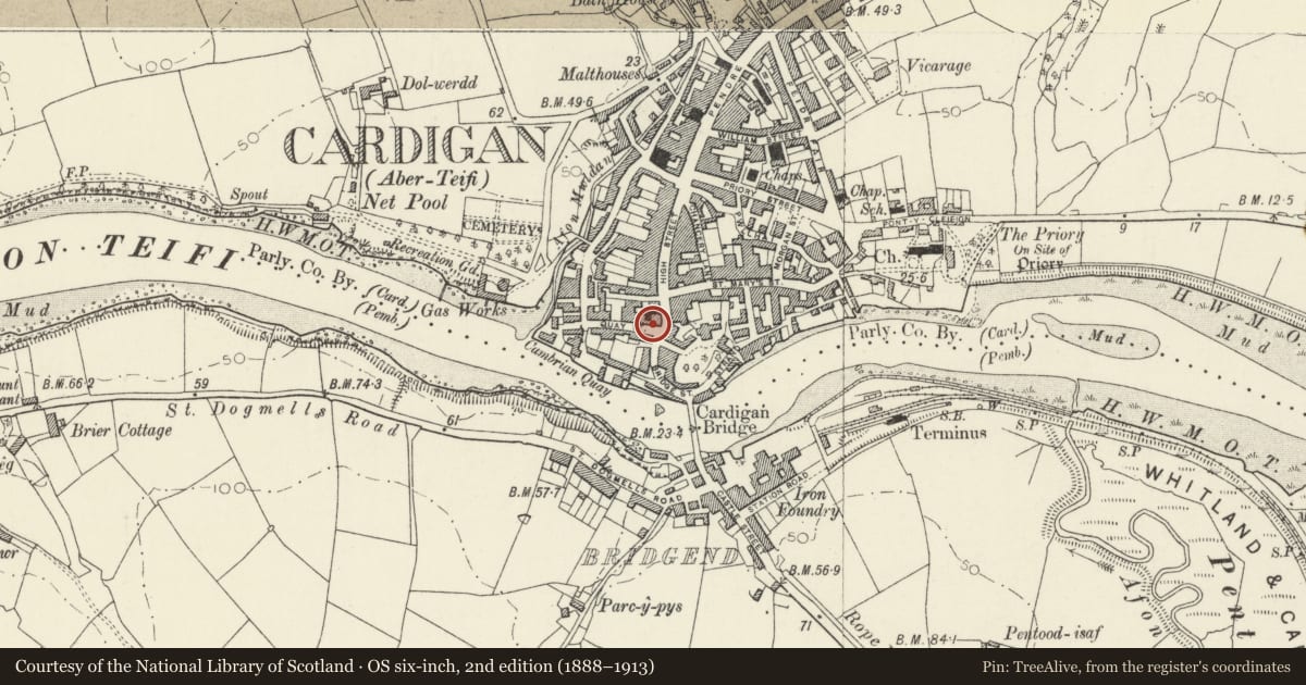
Slide toward Today to fade the historical sheet and see the modern map underneath.
David Rumsey Map Collection, Stanford LibrariesDavid Rumsey Map Collection, Stanford LibrariesDavid Rumsey Map Collection, Stanford LibrariesDavid Rumsey Map Collection, Stanford LibrariesDavid Rumsey Map Collection, Stanford Libraries
5 historical maps cover this location, the earliest the 1608 map "(13) Cambriae Typus." (David Rumsey Map Collection, Stanford Libraries).
Historical maps covering this location
- 1608 · (13) Cambriae Typus. (David Rumsey Map Collection, Stanford Libraries)
- 1637 · Particular description of Wales. Cambria seu Wallia (David Rumsey Map Collection, Stanford Libraries)
- 1830 · V.3:11-15:XV. Britisches Reich. A. Kon: England. b. Frstenthum Wales: Shire: 37-40 (David Rumsey Map Collection, Stanford Libraries)
- 1898 · 193 Cardigan (Hills) (David Rumsey Map Collection, Stanford Libraries)
- 1901 · Sheet 13. (David Rumsey Map Collection, Stanford Libraries)
Cadw's description
Location
Situated on north east corner of Quay Street.
History
Late C18 or early C19. In 1871 National Provincial Bank opened in Cardigan at 26 Quay Street. Marked on Wood's 1834 map of Cardigan.
Exterior
House in rubble stone banded in blue lias stone, with imitation slate roof and modern brick end stacks. Three storeys, 2-window range of sashes with slate sills, 6-pane to second floor, 12-pane to first floor. Second floor right window is replaced with plate glass sash. Ground floor has door to left, modern shopwindow to right over blocked basement light. Matching modern shopwindows to east end wall. Window frames of main front distorted by subsidence.
Built continuously with Nos 24 and 25.
Reason for designation
Group value.
Nearby in the register
- 25 Quay StreetDomesticunder 1 mi
- 24 Quay StreetDomesticunder 1 mi
- Manchester HouseDomesticunder 1 mi
- The Old Shire HallCommercialunder 1 mi
Other entries of the same register within about three miles of this one, by straight line.