Cof Cymru: National Historic Assets of Wales · Wales
Manchester House
Cardigan, Ceredigion, Wales
A Grade II listed building in Cardigan, Ceredigion, designated on 14 April 1992.
The record
- Designation
- Listed building, Grade II
- Broad class
- Domestic
- Date of designation
- 14 April 1992
- Community
- Cardigan
- Unitary authority
- Ceredigion
- Country
- Wales
- Coordinates
- 52.08174, -4.66156
- Cadw reference
- 10467
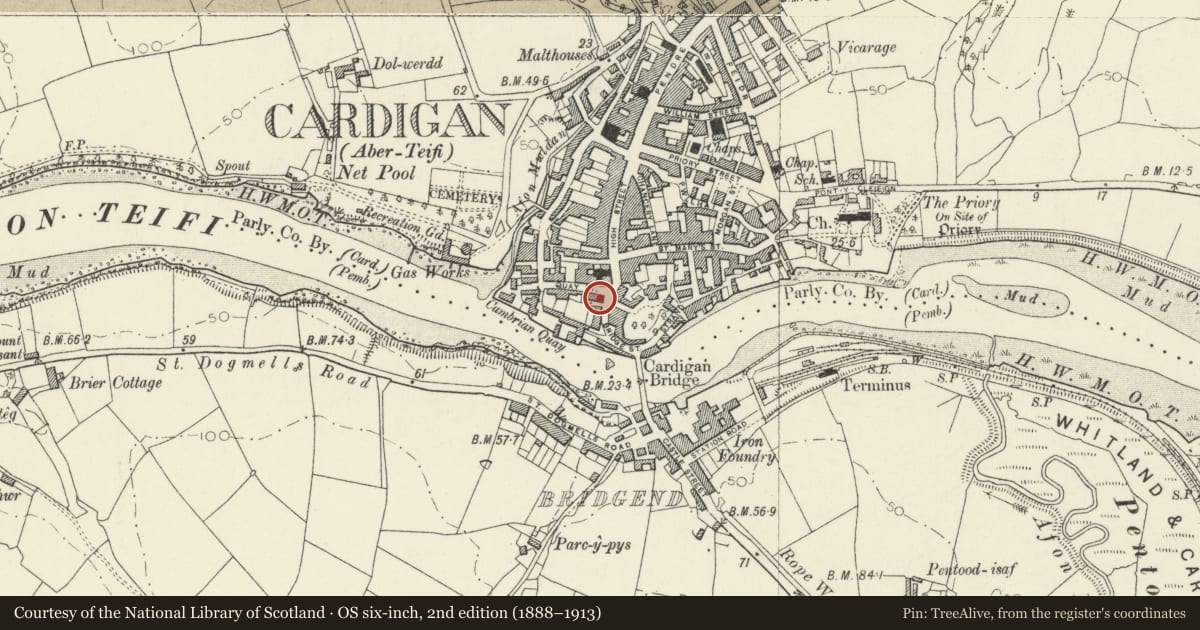
Slide toward Today to fade the historical sheet and see the modern map underneath.
David Rumsey Map Collection, Stanford LibrariesDavid Rumsey Map Collection, Stanford LibrariesDavid Rumsey Map Collection, Stanford LibrariesDavid Rumsey Map Collection, Stanford LibrariesDavid Rumsey Map Collection, Stanford Libraries
5 historical maps cover this location, the earliest the 1608 map "(13) Cambriae Typus." (David Rumsey Map Collection, Stanford Libraries).
Historical maps covering this location
- 1608 · (13) Cambriae Typus. (David Rumsey Map Collection, Stanford Libraries)
- 1637 · Particular description of Wales. Cambria seu Wallia (David Rumsey Map Collection, Stanford Libraries)
- 1830 · V.3:11-15:XV. Britisches Reich. A. Kon: England. b. Frstenthum Wales: Shire: 37-40 (David Rumsey Map Collection, Stanford Libraries)
- 1898 · 193 Cardigan (Hills) (David Rumsey Map Collection, Stanford Libraries)
- 1901 · Sheet 13. (David Rumsey Map Collection, Stanford Libraries)
Cadw's description
Location
Prominently situated at corner of Quay Street.
History
1884-5 built for John James, draper, to replace previous Manchester House, High Street. Former draper's warehouse and house by George Morgan,
Exterior
Warehouse, stucco with hipped slate roofs and red brick end stacks. Rough square plan with canted north west angle, 3-storey with 4-window fronts to Bridge Street and Quay Street. Bridge Street front has left bay of double width to allow for 2-storey canted bay window with tripartite sash above, upper giant pilasters with cornice and deep plain frieze under eaves. Plate glass sashes with painted slate sills and moulded band between floors, except in left bay where bay window has plain hipped roof. Similar one-window range to canted north west angle. Ground floor has channelled rustication to left angle pier and flanking adjoining bay window, then centre door between pilasters, shopfront to right, with matching pilaster to right and similar pilaster framing to shopwindow in canted angle. Overall entablature with moulded cornice, carried around the bay window. Centre panelled door with overlight. Shopfront has plate glass windows with deeply recessed centre door with overlight. Plainer 4-window front to Quay Street.
Interior
Shop interior has T-plan pitch-pine stair, single flight up to double flight return. Turned balusters.
Reason for designation
Group value.
Nearby in the register
- Dudley HouseDomesticunder 1 mi
- 1 Quay StreetDomesticunder 1 mi
- 25 Quay StreetDomesticunder 1 mi
- 26 Quay StreetDomesticunder 1 mi
Other entries of the same register within about three miles of this one, by straight line.