Cof Cymru: National Historic Assets of Wales · Wales
Gallery 72
Aberystwyth, Ceredigion, Wales
A Grade II listed building in Aberystwyth, Ceredigion, designated on 24 November 1987.
The record
- Designation
- Listed building, Grade II
- Broad class
- Commercial
- Date of designation
- 24 November 1987
- Community
- Aberystwyth
- Unitary authority
- Ceredigion
- Country
- Wales
- Coordinates
- 52.41475, -4.08659
- Cadw reference
- 10353
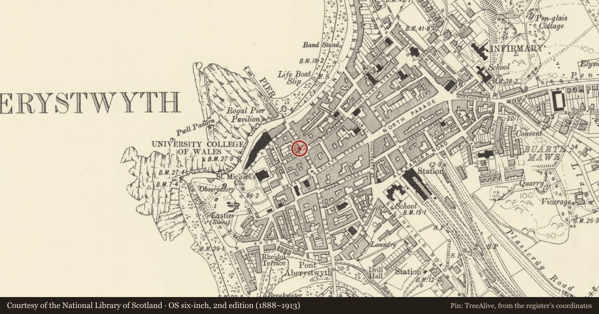
Slide toward Today to fade the historical sheet and see the modern map underneath.
David Rumsey Map Collection, Stanford LibrariesDavid Rumsey Map Collection, Stanford LibrariesDavid Rumsey Map Collection, Stanford LibrariesDavid Rumsey Map Collection, Stanford LibrariesDavid Rumsey Map Collection, Stanford Libraries
5 historical maps cover this location, the earliest the 1830 map "V.3:11-15:XV. Britisches Reich. A. Kon: England. b. Frstenthum Wales: Shire: 37-40" (David Rumsey Map Collection, Stanford Libraries).
Historical maps covering this location
- 1830 · V.3:11-15:XV. Britisches Reich. A. Kon: England. b. Frstenthum Wales: Shire: 37-40 (David Rumsey Map Collection, Stanford Libraries)
- 1883 · Watershed map England, Wales 3. (David Rumsey Map Collection, Stanford Libraries)
- 1896 · Sheet 7. Ordnance Survey of England and Wales. (David Rumsey Map Collection, Stanford Libraries)
- 1899 · 163 Aberystwyth (Hills) (David Rumsey Map Collection, Stanford Libraries)
- 1901 · Sheet 14. (David Rumsey Map Collection, Stanford Libraries)
Cadw's description
Location
On the corner with New Street at the top the terrace leading down towards the seafront.
History
Shown on 1809 map.
Exterior
Late Georgian 3-storey and attic stucco front, tall slate roof with wide bracket eaves, rendered chimney stacks with cornice and flat roof dormer offset to right. Small pane sash windows with architraves, lugged to 1st floor, bracket cills to 2nd floor; central window broader and with detached broad cornice below blocked central 2nd floor window. Victorian shop front, and blocked entrance with overall cornice, fluted pilasters and fascia ends to windows with colonnettes curve into recessed entrance with patterned ‘doormat’ and fanlight over half-glazed door. Blocked entrance to left with mutilated doorcase, modern shop window inserted.
Stucco 3-storey, 3-window New Street front; deep cill band to 1st floor over grooved ground floor that overlaps the corner. Blocked 2nd floor windows with architraves and bracket cills; 1st floor lugged architraves to one blocked window and two small pane sash glazed windows. Modern ground floor entrance and 2-storey entrance extension to rear.
Interior
Interior retains contemporary details including painted bracket cornices and acanthus ornamented former main entrance arch.
Reason for designation
Group value.
Nearby in the register
- Mander & SonCommercialunder 1 mi
- Mandarin Chinese RestaurantCommercialunder 1 mi
- 3 New StreetCommercialunder 1 mi
- 2&4 New StreetCommercialunder 1 mi
Other entries of the same register within about three miles of this one, by straight line.