Cof Cymru: National Historic Assets of Wales · Wales
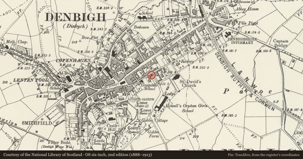
13 Park Street
Denbigh, Denbighshire, Wales
A Grade II listed building in Denbigh, Denbighshire, designated on 2 February 1981.
The record
- Designation
- Listed building, Grade II
- Broad class
- Domestic
- Date of designation
- 2 February 1981
- Locality
- Denbigh
- Community
- Denbigh
- Unitary authority
- Denbighshire
- Country
- Wales
- Coordinates
- 53.18403, -3.41631
- Cadw reference
- 1012
Slide toward Today to fade the historical sheet and see the modern map underneath.
David Rumsey Map Collection, Stanford LibrariesLlyfrgell Genedlaethol Cymru – The National Library of WalesDavid Rumsey Map Collection, Stanford LibrariesDavid Rumsey Map Collection, Stanford LibrariesDavid Rumsey Map Collection, Stanford Libraries
5 historical maps cover this location, the earliest the 1608 map "(13) Cambriae Typus." (David Rumsey Map Collection, Stanford Libraries).
Historical maps covering this location
- 1608 · (13) Cambriae Typus. (David Rumsey Map Collection, Stanford Libraries)
- 1795 · To Sir Watkin Williams-Wynn Bart ... the map of the six counties of North Wales is most… (Llyfrgell Genedlaethol Cymru – The National Library of Wales)
- 1830 · V.3:11-15:XV. Britisches Reich. A. Kon: England. b. Frstenthum Wales: Shire: 37-40 (David Rumsey Map Collection, Stanford Libraries)
- 1883 · Watershed map England, Wales 3. (David Rumsey Map Collection, Stanford Libraries)
- 1901 · Sheet 9 and 10. (David Rumsey Map Collection, Stanford Libraries)
Cadw's description
Location
On the SE side of Park Street, immediately west of the southerly continuation of Peake’s Lane which forms the main access to Howell’s School.
History
The two houses appear to have been built or remodelled as a pair in the early C19. The imprint of an earlier building on the site, however, may be suggested in the unequal ground plan of the two houses which are otherwise similar. Broadly symmetrical, the fall of the ground did not permit the windows to align throughout, but did allow an extra storey in number 15, and later additions to the rear have also disturbed the original symmetry.
Reason for designation
Listed as a good pair of early C19 town houses, retaining original character and detail, and possibly incorporating traces of earlier buildings on their site.
Nearby in the register
- 15 Park StreetDomesticunder 1 mi
- 17 Park StreetDomesticunder 1 mi
- Former Heaton Town House (currently premises of Whiteheads Blinds and Happy Homes Furniture)Commercialunder 1 mi
- Garden Wall to rear of No.44 Vale Street, on E, W and S SidesDomesticunder 1 mi
Other entries of the same register within about three miles of this one, by straight line.