Cof Cymru: National Historic Assets of Wales · Wales
Garden Wall to rear of No.44 Vale Street, on E, W and S Sides
Denbigh, Denbighshire, Wales
A Grade II listed building in Denbigh - Town, Denbigh, Denbighshire, designated on 2 February 1981.
The record
- Designation
- Listed building, Grade II
- Broad class
- Domestic
- Date of designation
- 2 February 1981
- Locality
- Denbigh - Town
- Community
- Denbigh
- Unitary authority
- Denbighshire
- Country
- Wales
- Coordinates
- 53.18454, -3.41623
- Cadw reference
- 14821
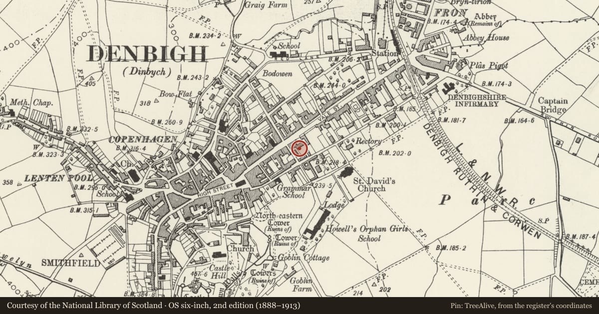
Slide toward Today to fade the historical sheet and see the modern map underneath.
David Rumsey Map Collection, Stanford LibrariesLlyfrgell Genedlaethol Cymru – The National Library of WalesDavid Rumsey Map Collection, Stanford LibrariesDavid Rumsey Map Collection, Stanford LibrariesDavid Rumsey Map Collection, Stanford Libraries
5 historical maps cover this location, the earliest the 1608 map "(13) Cambriae Typus." (David Rumsey Map Collection, Stanford Libraries).
Historical maps covering this location
- 1608 · (13) Cambriae Typus. (David Rumsey Map Collection, Stanford Libraries)
- 1795 · To Sir Watkin Williams-Wynn Bart ... the map of the six counties of North Wales is most… (Llyfrgell Genedlaethol Cymru – The National Library of Wales)
- 1830 · V.3:11-15:XV. Britisches Reich. A. Kon: England. b. Frstenthum Wales: Shire: 37-40 (David Rumsey Map Collection, Stanford Libraries)
- 1883 · Watershed map England, Wales 3. (David Rumsey Map Collection, Stanford Libraries)
- 1901 · Sheet 9 and 10. (David Rumsey Map Collection, Stanford Libraries)
Cadw's description
Location
Forms the boundary to the garden at the rear of No.44 Vale Street.
History
Early C18 garden wall originally serving Mostyn House, the Denbigh town house of the Mostyn family.
Exterior
East side: mainly 1.8m, old red brick, perhaps C18 or earlier. West side: lower 1.5m rubble, upper 1.2m red brick, both probably later. South side: about 1.5m, red brick, possibly C18, with rustic stone cresting.
Reason for designation
Listed as a sequence of C18 garden walls and of special interest as a valuable relic of the original garden layout of the early Georgian Mostyn House.
Group value with other listed items at no.44 Vale Street.
Nearby in the register
- 44 Vale StreetDomesticunder 1 mi
- Mostyn HouseDomesticunder 1 mi
- Clergy HouseDomesticunder 1 mi
- Forecourt Walls and Gatepiers to No 44 Vale StreetDomesticunder 1 mi
Other entries of the same register within about three miles of this one, by straight line.