Cof Cymru: National Historic Assets of Wales · Wales
Pont Sylltu
Llangernyw, Conwy, Wales
A Grade II listed building in Llangernyw, Abergele, Conwy, designated on 23 June 1967.
The record
- Designation
- Listed building, Grade II
- Broad class
- Transport
- Date of designation
- 23 June 1967
- Locality
- Llangernyw
- Town
- Abergele
- Community
- Llangernyw
- Unitary authority
- Conwy
- Country
- Wales
- Coordinates
- 53.18532, -3.67224
- Cadw reference
- 100
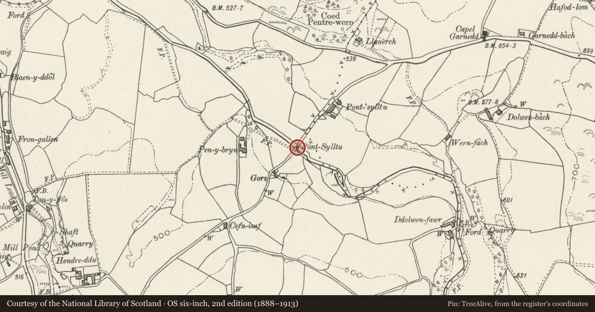
Slide toward Today to fade the historical sheet and see the modern map underneath.
David Rumsey Map Collection, Stanford LibrariesLlyfrgell Genedlaethol Cymru – The National Library of WalesDavid Rumsey Map Collection, Stanford LibrariesDavid Rumsey Map Collection, Stanford LibrariesDavid Rumsey Map Collection, Stanford Libraries
5 historical maps cover this location, the earliest the 1608 map "(13) Cambriae Typus." (David Rumsey Map Collection, Stanford Libraries).
Historical maps covering this location
- 1608 · (13) Cambriae Typus. (David Rumsey Map Collection, Stanford Libraries)
- 1795 · To Sir Watkin Williams-Wynn Bart ... the map of the six counties of North Wales is most… (Llyfrgell Genedlaethol Cymru – The National Library of Wales)
- 1830 · V.3:11-15:XV. Britisches Reich. A. Kon: England. b. Frstenthum Wales: Shire: 37-40 (David Rumsey Map Collection, Stanford Libraries)
- 1883 · Watershed map England, Wales 3. (David Rumsey Map Collection, Stanford Libraries)
- 1901 · Sheet 9 and 10. (David Rumsey Map Collection, Stanford Libraries)
Cadw's description
Location
The bridge carries the minor road between Llangernyw and Gwytherin over the Afon Cledwen approximately 1.5km SE of Llangernyw village.
History
Built in early C19 to the specification of Thomas Penson, County Surveyor of Denbigh under contract dated 1st May 1822. According to the contract the bridge replaced a ruinous one nearby and was to incorporate salvaged stone from the old bridge as well as new stone from quarries near Dolwen.
Exterior
Road bridge, gently cambered, built of local stone rubble. A single semi-eliptical arch with hammer-faced voussoirs. Spandrels rise to a projecting cambered string course at road level; parapet coped with flush limestone slabs linked with iron cramps. The parapets sweep outward at each end.
Reason for designation
Included as a good example of an early C19 country road bridge of the type associated with improvements in rural communications carried out in the late C18 and early C19.
Nearby in the register
- Cartshed, Barn, Byre and Shed at Hendre DduAgriculture and Subsistenceunder 1 mi
- Farmyard ranges at Hendre DduAgriculture and Subsistenceunder 1 mi
- Hendre DduAgriculture and Subsistenceunder 1 mi
- Pont FaenTransportunder 1 mi
Other entries of the same register within about three miles of this one, by straight line.