Historic Buildings Record · Northern Ireland
Lime Kiln
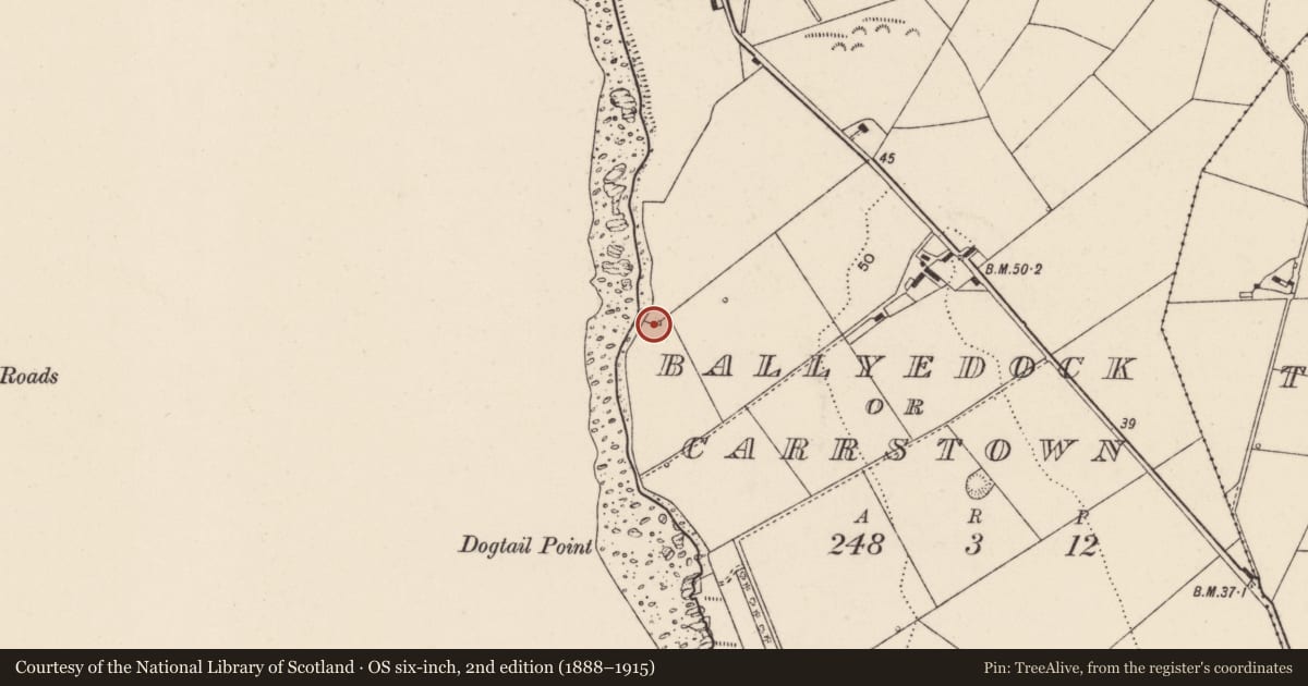
Ballydock, Ards and North Down, Northern Ireland
The record
- Designation
- Record only (not listed)
- Grade
- Record Only
- Type
- Rural Industry
- Date of construction
- 1840 - 1859
- Address
- Lime Kiln, Ballydock, Portaferry, Co Down
- Townland
- Ballydock
- Council
- Ards and North Down
- Country
- Northern Ireland
- Coordinates
- 54.35006, -5.52936
- Date of survey
- 08 September 1997
- HB reference
- HB24/01/169
Slide toward Today to fade the historical sheet and see the modern map underneath.
David Rumsey Map Collection, Stanford LibrariesDavid Rumsey Map Collection, Stanford LibrariesDavid Rumsey Map Collection, Stanford Libraries
3 historical maps cover this location, the earliest the 1794 map "Sheet 55. (Cary's England, Wales, and Scotland)." (David Rumsey Map Collection, Stanford Libraries).
Historical maps covering this location
- 1794 · Sheet 55. (Cary's England, Wales, and Scotland). (David Rumsey Map Collection, Stanford Libraries)
- 1838 · Ireland, north sheet. (David Rumsey Map Collection, Stanford Libraries)
- 1841 · Ireland. (David Rumsey Map Collection, Stanford Libraries)
The Department's description
Exterior description and setting
Disused snecked rubble lime kiln, of possible mid 19th century construction, built into a slight bank and now in poor order. The kiln is set close to the coastline, within a field to the S of Barr Hall Road, c.3 miles S of Portaferry.
The front face has a central ‘fireplace' opening (now partly collapsed). The front and side walls are slightly battered while the rear face is obscured by the earth access ramp. The main walls may have been lowered in height.
Historical information
This lime kiln may have been constructed in the mid 19th century.
References- Secondary sources.
1 T. Ferris, "Lime Kilns of the Ards" in 'Journal of the Upper Ards Historical Society No.2' (1978), p.4
Criteria for listing: architectural interest
Not listed
Criteria for listing: historic interest
Not listed
Evaluation
Disused snecked rubble lime kiln, of possible mid 19th century construction, built into a slight bank and now in poor order.
Nearby in the register
- Marine navigation BeaconLight House/ Navigation Markunder 1 mi
- 15 Ballyfounder RoadHouse1 mi
- 6 Ballyquintin RoadHouse1 mi
- Folly CastleWatch tower1 mi
Other entries of the same register within about three miles of this one, by straight line.