Historic Buildings Record · Northern Ireland
Abbeylands Hotel,
Antrim and Newtownabbey, Northern Ireland
The record
- Designation
- Record only (not listed)
- Grade
- Record Only
- Type
- Residential Home
- Address
- Abbeylands Hotel,, Shore Road,, Whiteabbey,, Co.Antrim
- Council
- Antrim and Newtownabbey
- Country
- Northern Ireland
- Coordinates
- 54.66913, -5.89976
- Date of survey
- 21 October 2008
- HB reference
- HB21/07/015
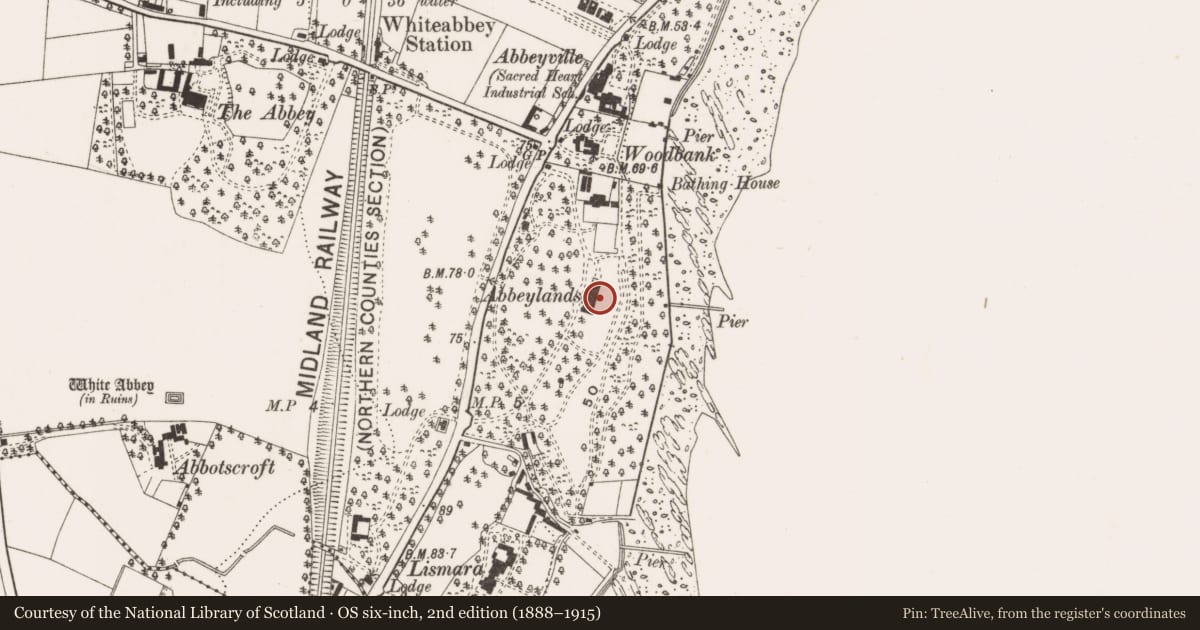
Slide toward Today to fade the historical sheet and see the modern map underneath.
David Rumsey Map Collection, Stanford LibrariesDavid Rumsey Map Collection, Stanford LibrariesDavid Rumsey Map Collection, Stanford LibrariesDavid Rumsey Map Collection, Stanford Libraries
4 historical maps cover this location, the earliest the 1636 map "Vltoniae Orientalis Pars" (David Rumsey Map Collection, Stanford Libraries).
Historical maps covering this location
- 1636 · Vltoniae Orientalis Pars (David Rumsey Map Collection, Stanford Libraries)
- 1794 · Sheet 55. (Cary's England, Wales, and Scotland). (David Rumsey Map Collection, Stanford Libraries)
- 1811 · Ireland. (David Rumsey Map Collection, Stanford Libraries)
- 1891 · Ireland 16 (David Rumsey Map Collection, Stanford Libraries)
The Department's description
Exterior description and setting
Detached five-bay two-storey redbrick house, built c.1930, facing west set back from the road in its own grounds to the east of Shore Road, with various extensions and wings added c.1980. Now in use as a Nursing Home.
A detached three-bay single-storey gate lodge formerly positioned along Shore Road has since been demolished.
Historical information
N/A
Criteria for listing: architectural interest
Not listed
Criteria for listing: historic interest
Not listed
Evaluation
Detached five-bay two-storey redbrick house, built c.1930, facing west set back from the road in its own grounds to the east of Shore Road, with various extensions and wings added c.1980. Now in use as a Nursing Home. The removal of the distinctive chimneystacks, the addition of the various glazed sections to the front and the extensive accretions to the rear and north, has resulted in the loss of the original character and architectural merit.
General comments
This building is not worthy of a full Second Survey. A partial record has been taken as this building was surveyed in the First Survey but not listed at that time.
Nearby in the register
- Folly at WillowbrookDemolishedunder 1 mi
- 662 Shore RoadDemolishedunder 1 mi
- WoodbankHouseunder 1 mi
- Immaculata Special School,No type recordedunder 1 mi
Other entries of the same register within about three miles of this one, by straight line.