Historic Buildings Record · Northern Ireland
Seapatrick Mills
Armagh City, Banbridge and Craigavon, Northern Ireland
The record
- Designation
- Record only (not listed)
- Grade
- Record Only
- Type
- No type recorded
- Address
- Seapatrick Mills, Lurgan Road, Banbridge, Co. Down, BT63
- Council
- Armagh City, Banbridge and Craigavon
- Country
- Northern Ireland
- Coordinates
- 54.36469, -6.27986
- Date of survey
- 28 March 2012
- HB reference
- HB17/04/019
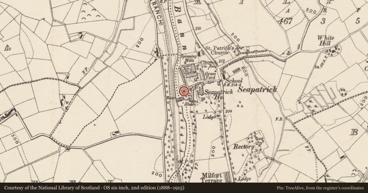
Slide toward Today to fade the historical sheet and see the modern map underneath.
David Rumsey Map Collection, Stanford LibrariesDavid Rumsey Map Collection, Stanford LibrariesDavid Rumsey Map Collection, Stanford LibrariesDavid Rumsey Map Collection, Stanford Libraries
4 historical maps cover this location, the earliest the 1636 map "Vltoniae Orientalis Pars" (David Rumsey Map Collection, Stanford Libraries).
Historical maps covering this location
- 1636 · Vltoniae Orientalis Pars (David Rumsey Map Collection, Stanford Libraries)
- 1811 · Ireland. (David Rumsey Map Collection, Stanford Libraries)
- 1841 · Ireland. (David Rumsey Map Collection, Stanford Libraries)
- 1891 · Ireland 16 (David Rumsey Map Collection, Stanford Libraries)
The Department's description
Exterior description and setting
A mid- to late-nineteenth century mill of little architectural interest, located on Lurgan Road, Banbridge, now demolished and replaced by a housing development.
The First Survey card records:
‘Later C.19. None of the existing buildings are earlier than around 1864, the original building was c.1826. Apart from historical background and a little patterned brickwork there is little of interest.
This was first power loom factory on Bann and perhaps in Irish linen industry. In 1826 William Hayes’ 3rd son, Frederick William was given a grant by the Linen Trustees for spinning fine yarns by machinery. Firm concentrated on thread making from 1864.
Smaller “Bleaching mill” shown on O.S. Map of 1833.
Industrial Archaeology of Co. Down E.R.R.Green
Date of visit: 9th October 1969’
Historical information
N/A
Criteria for listing: architectural interest
Not listed
Criteria for listing: historic interest
Not listed
Evaluation
A mid- to late-nineteenth century mill of little architectural interest, located on Lurgan Road, Banbridge, now demolished and replaced by a housing development.
General comments
Partial Survey Only
Nearby in the register
- Gate LodgeNo type recordedunder 1 mi
- St Patricks ChurchChurchunder 1 mi
- 91 Lurgan RoadHouse - Terraceunder 1 mi
- 95 Lurgan RoadHouse - Terraceunder 1 mi
Other entries of the same register within about three miles of this one, by straight line.