Historic Buildings Record · Northern Ireland
Cranagill Methodist Church
Cranagill, Armagh City, Banbridge and Craigavon, Northern Ireland
The record
- Designation
- Record only (not listed)
- Grade
- Record Only
- Type
- Church
- Date of construction
- 1880 - 1899
- Address
- Cranagill Methodist Church, Ardress Road, Portadown, Craigavon, Co Armagh
- Townland
- Cranagill
- Council
- Armagh City, Banbridge and Craigavon
- Country
- Northern Ireland
- Coordinates
- 54.44548, -6.57576
- Date of survey
- 31 December 2004
- HB reference
- HB15/02/042
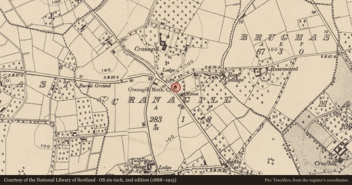
Slide toward Today to fade the historical sheet and see the modern map underneath.
David Rumsey Map Collection, Stanford LibrariesDavid Rumsey Map Collection, Stanford LibrariesDavid Rumsey Map Collection, Stanford LibrariesDavid Rumsey Map Collection, Stanford Libraries
4 historical maps cover this location, the earliest the 1868 map "4. Ireland." (David Rumsey Map Collection, Stanford Libraries).
Historical maps covering this location
- 1868 · 4. Ireland. (David Rumsey Map Collection, Stanford Libraries)
- 1869 · Ireland. (David Rumsey Map Collection, Stanford Libraries)
- 1881 · Ireland to Illustrate the Military Condition of the Country. (David Rumsey Map Collection, Stanford Libraries)
- 1891 · Ireland 16 (David Rumsey Map Collection, Stanford Libraries)
The Department's description
Exterior description and setting
A single storey church with round-headed windows and doorway. Main entrance faces south-west.
Roof slated; metal ventilator on ridge; plain timber bargeboards. Walls rendered, dry dash, on smooth rendered plinth; raised smooth rendered quoins to extremities; low smooth rendered buttresses between windows on side elevations; lozenge-shaped smooth rendered panel on front gable inscribed "Cranagill Methodist Church 1881". Central doorway in front gable, semi-circular arched, with moulded columnar jambs enclosing a panelled timber door and panelled tympanum; drip moulding and squared panelled shoulders. Three sets of coupled semi-circular arched windows to side elevations, with horizontal glazing bars, and narrow moulded surrounds. Blind rear gable with lower later projecting lean-to addition.
SETTING: The building stands in a rural location, on a corner site, with grassed area, hard surfaced car park, and mature trees.
Historical information
Built in 1881 according to the datestone on the building.
References – Primary Sources
1. Datestone on building.
2. OS Map 1954, Co Armagh 5.
Criteria for listing: architectural interest
Not listed
Criteria for listing: historic interest
Not listed
Evaluation
This is a late 19th century church of no special architectural or historic interest.
Nearby in the register
- King Edward VII post boxPost Boxunder 1 mi
- CRANNAGAELHOUSEunder 1 mi
- Rose CottageDemolishedunder 1 mi
- 16 Tallbridge RoadNo type recordedunder 1 mi
Other entries of the same register within about three miles of this one, by straight line.