Historic Buildings Record · Northern Ireland
House
Drumshancorick, Fermanagh and Omagh, Northern Ireland
The record
- Designation
- Record only (not listed)
- Grade
- Record Only
- Type
- House
- Date of construction
- 1820 - 1839
- Address
- House, Drumshancorick, Rosslea, Co Fermanagh, BT92 7HP
- Townland
- Drumshancorick
- Council
- Fermanagh and Omagh
- Country
- Northern Ireland
- Coordinates
- 54.25047, -7.20606
- Date of survey
- 13 September 2000
- HB reference
- HB12/01/090
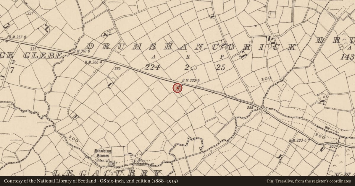
Slide toward Today to fade the historical sheet and see the modern map underneath.
David Rumsey Map Collection, Stanford LibrariesDavid Rumsey Map Collection, Stanford LibrariesDavid Rumsey Map Collection, Stanford LibrariesDavid Rumsey Map Collection, Stanford Libraries
4 historical maps cover this location, the earliest the 1811 map "Ireland." (David Rumsey Map Collection, Stanford Libraries).
Historical maps covering this location
- 1811 · Ireland. (David Rumsey Map Collection, Stanford Libraries)
- 1817 · Ireland. (David Rumsey Map Collection, Stanford Libraries)
- 1825 · Ireland. (David Rumsey Map Collection, Stanford Libraries)
- 1830 · V.3:11-15:XV. Britisches Reich. C. Kon: Ireland. b. Prov: Ulster. Counties: 13-21 (David Rumsey Map Collection, Stanford Libraries)
The Department's description
Exterior description and setting
A single storey/ three bay vernacular hearth-lobby house aligned SW-NE to the S of the road bisecting Drumshancorick Townland.
Roof is pitched corrugated asbestos with a lime-rendered chimney to party wall between each bay. Rainwater goods are half-round metal. Walls are lime-rendered.
Principal elevation faces SE. Central bay is wider and has a projecting porch to left and the remains of a 2/2 sliding sash window (boarded with timber sheeting) to right. Porch has a flat cement coped roof and a door opening with narrow sidelights to front face. Right and left cheeks are blank. Left and right bays each have a window opening; that to left has the remains of a timber side hung casement window.
Left and right gables are blank. That to left is abutted by an open lean-to shed of timber frame construction supporting a corrugated metal roof.
Rear elevation has the remains of a 2/2 sliding sash window set to right of centre.
Historical information
A building is shown at this location on the 1834 OS 6” map.
Primary sources:
1. OS map, 1st edition 1834, Co Fermanagh 36.
Criteria for listing: architectural interest
Not listed
Criteria for listing: historic interest
Not listed
Evaluation
A hearth-lobby vernacular dwelling occupying a pleasant roadside setting and retaining some original features.
Nearby in the register
Other entries of the same register within about three miles of this one, by straight line.