Historic Buildings Record · Northern Ireland
House near Bessbrook
Tullyhoe, Causeway Coast and Glens, Northern Ireland
The record
- Designation
- Record only (not listed)
- Grade
- Record Only
- Type
- House
- Date of construction
- 1820 - 1839
- Address
- House near Bessbrook, Clooney Road, Rascahan, Limavady, Co Londonderry, BT49
- Townland
- Tullyhoe
- Council
- Causeway Coast and Glens
- Country
- Northern Ireland
- Coordinates
- 55.05112, -6.98365
- Date of survey
- 15 June 1997
- HB reference
- HB02/10/023
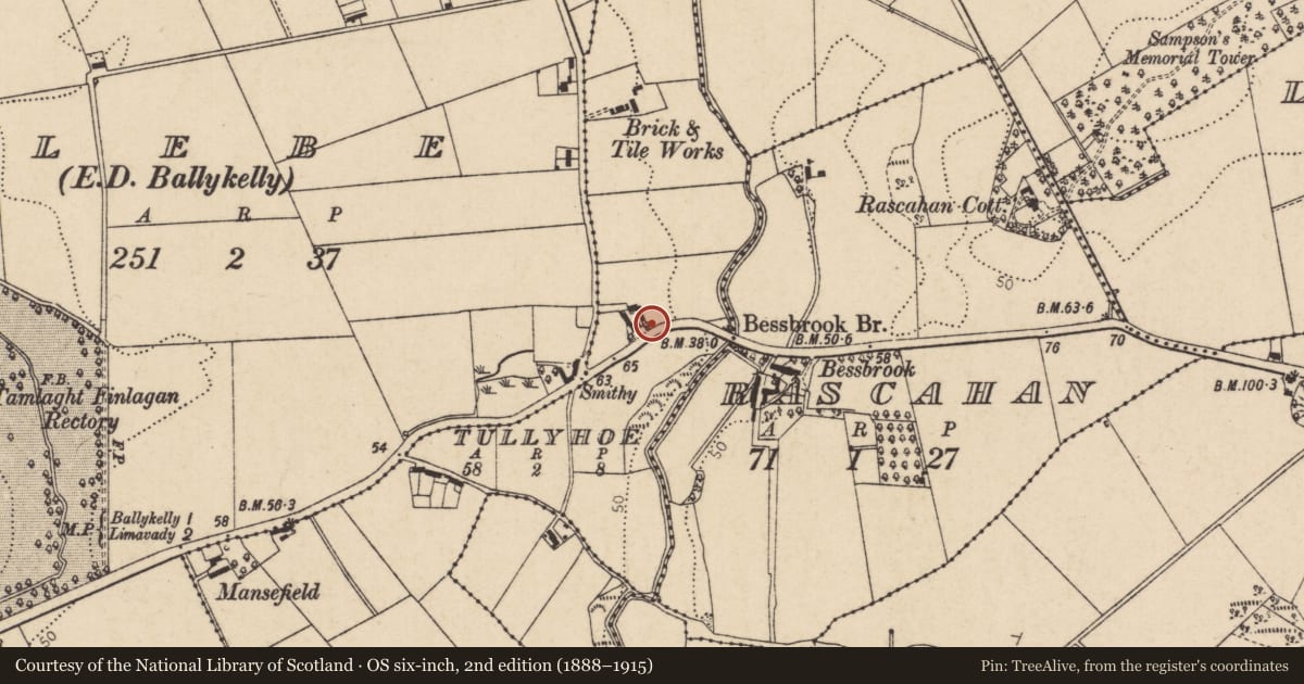
Slide toward Today to fade the historical sheet and see the modern map underneath.
David Rumsey Map Collection, Stanford LibrariesDavid Rumsey Map Collection, Stanford LibrariesDavid Rumsey Map Collection, Stanford LibrariesDavid Rumsey Map Collection, Stanford Libraries
4 historical maps cover this location, the earliest the 1811 map "Ireland." (David Rumsey Map Collection, Stanford Libraries).
Historical maps covering this location
- 1811 · Ireland. (David Rumsey Map Collection, Stanford Libraries)
- 1817 · Ireland. (David Rumsey Map Collection, Stanford Libraries)
- 1825 · Ireland. (David Rumsey Map Collection, Stanford Libraries)
- 1830 · V.3:11-15:XV. Britisches Reich. C. Kon: Ireland. b. Prov: Ulster. Counties: 13-21 (David Rumsey Map Collection, Stanford Libraries)
The Department's description
Exterior description and setting
Two storey house with pitched roof very much altered. Could be regarded as a new house,ie mid to late 20th. C.
Described in the first survey in September 1970 as 'A 2 1/2 storey brick house three windows wide with slated roof. On the front elevation lower windows have been replaced by D/H sashes with horizontal division. Upper windows retain full glazing bars. One of the lower windows was originally much wider.'
Historical information
Appears on 1830 map.
Criteria for listing: architectural interest
Not listed
Criteria for listing: historic interest
Not listed
Evaluation
An early 19th. C. house, but so much altered as to be no longer of any interest.
Nearby in the register
- Bessbrook HouseHouseunder 1 mi
- Rascahan CottageHouseunder 1 mi
- Mansefield HouseHouseunder 1 mi
- LodgeHouseunder 1 mi
Other entries of the same register within about three miles of this one, by straight line.