Historic Buildings Record · Northern Ireland
Dwelling House 2
Derry City and Strabane, Northern Ireland
The record
- Designation
- Record only (not listed)
- Grade
- Record Only
- Type
- No type recorded
- Address
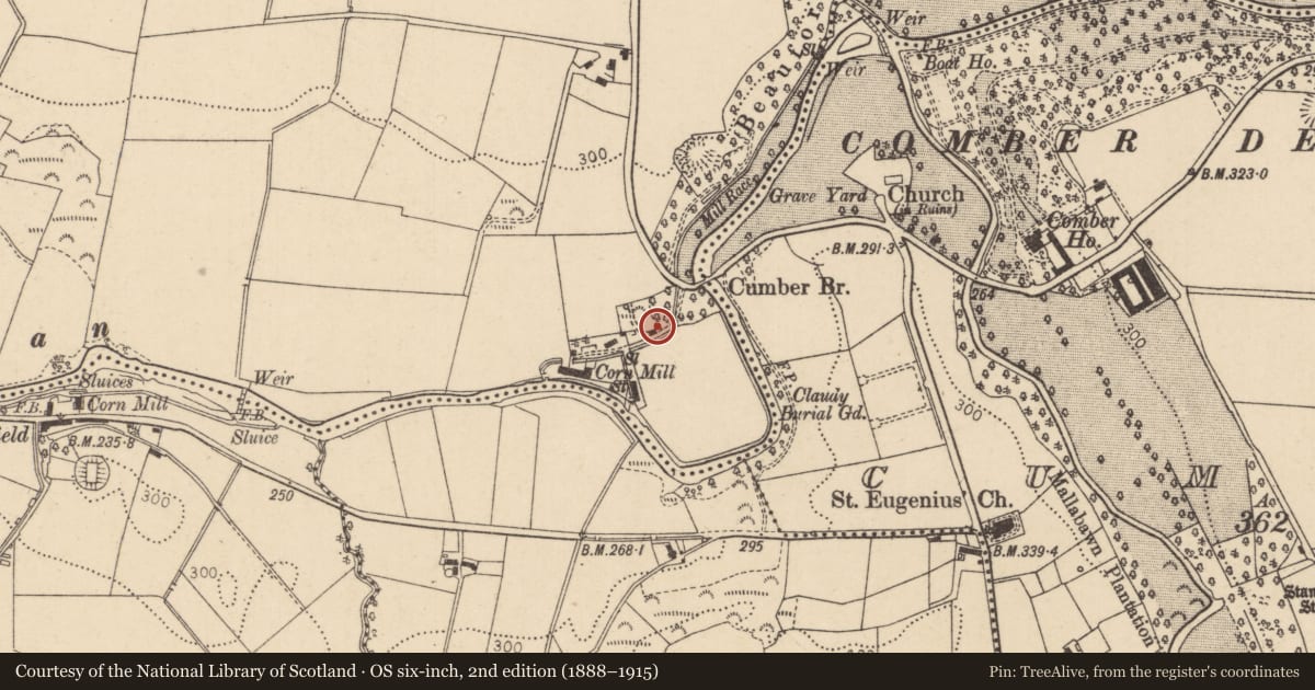
- Dwelling House 2, Mill buildings at Cumber Bridge, Claudy, County Londonderry
- Council
- Derry City and Strabane
- Country
- Northern Ireland
- Coordinates
- 54.90415, -7.16618
- Date of survey
- 19 February 2014
- HB reference
- HB01/02/037 A
Slide toward Today to fade the historical sheet and see the modern map underneath.
David Rumsey Map Collection, Stanford LibrariesDavid Rumsey Map Collection, Stanford LibrariesDavid Rumsey Map Collection, Stanford LibrariesDavid Rumsey Map Collection, Stanford Libraries
4 historical maps cover this location, the earliest the 1869 map "Ireland." (David Rumsey Map Collection, Stanford Libraries).
Historical maps covering this location
- 1869 · Ireland. (David Rumsey Map Collection, Stanford Libraries)
- 1881 · Ireland to Illustrate the Military Condition of the Country. (David Rumsey Map Collection, Stanford Libraries)
- 1891 · Ireland 16 (David Rumsey Map Collection, Stanford Libraries)
- 1900 · Ireland (David Rumsey Map Collection, Stanford Libraries)
The Department's description
Exterior description and setting
A symmetrical two-storey rubble stone building with pitched natural slate roof comprising two dwellings. The dwellings are now vacant and a modern storey-and-a-half dwelling has been attached to the west gable and is set back from the front elevation.
Although some features survive, there have been inappropriate alterations and it has lost of its chimney on the western gable.
Historical information
N/A
Criteria for listing: architectural interest
Not listed
Criteria for listing: historic interest
Not listed
Evaluation
A symmetrical two-storey rubble stone building with pitched natural slate roof comprising two dwellings associated with the adjacent mill complex to the south-west of Cumber Bridge, Claudy. The dwellings are now vacant and a modern storey-and-a-half dwelling has been attached to the west gable and is set back from the front elevation.
Although some features survive, inappropriate alterations and the loss of its chimney on the western gable compromises its interest; there are other, more complete, examples listed in the District.
General comments
Partial survey only - Although some features survive, inappropriate alterations and the loss of its chimney on the western gable compromises its interest; there are other, more complete, examples listed in the District.
Nearby in the register
- Dwelling House 1No type recordedunder 1 mi
- Flax MillNo type recordedunder 1 mi
- Cumber BridgeBridgeunder 1 mi
- Graveyard at JunctionNo type recordedunder 1 mi
Other entries of the same register within about three miles of this one, by straight line.