Sites and Monuments Record · Ireland
Windmill
Drinagh South, County Wexford, Ireland
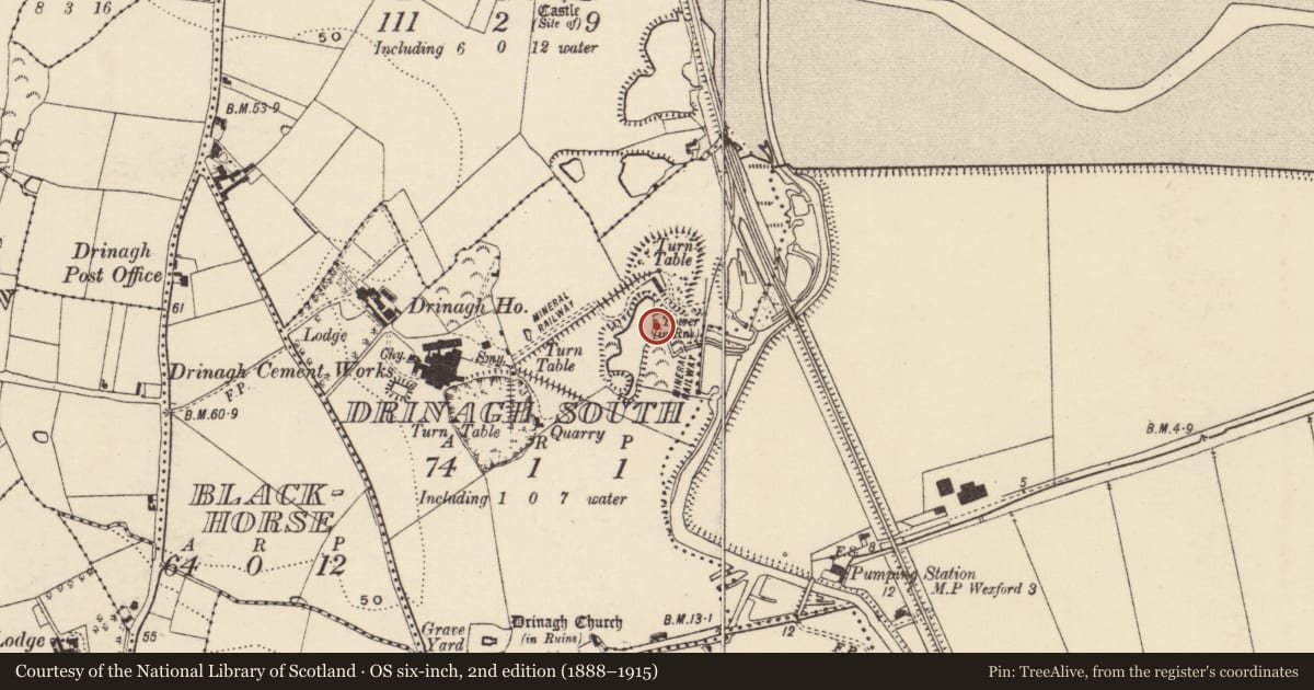
The record
- Townland
- Drinagh South
- County
- Wexford
- Country
- Ireland
- First-edition OS map
- Windmill
- Latest-edition OS map
- Tower (in Ruins)
- Coordinates
- 52.30550, -6.44841
- SMR number
- WX042-078----
Slide toward Today to fade the historical sheet and see the modern map underneath.
University Library, Vrije Universiteit AmsterdamUniversity Library, Vrije Universiteit AmsterdamDavid Rumsey Map Collection, Stanford LibrariesDavid Rumsey Map Collection, Stanford Libraries
4 historical maps cover this location, the earliest the 1811 map "Ireland." (David Rumsey Map Collection, Stanford Libraries).
Historical maps covering this location
- 1811 · Ireland. (David Rumsey Map Collection, Stanford Libraries)
- 1891 · Ireland 16 (David Rumsey Map Collection, Stanford Libraries)
- 1904 · Sheet 14, 1904 (University Library, Vrije Universiteit Amsterdam)
- 1911 · Sheet 14, 1911 (University Library, Vrije Universiteit Amsterdam)
This record in the National Monuments Service's Historic Environment Viewer ↗
The National Monuments Service's description
Marked on the 1839 ed. of the OS 6 inch map where it is described as a windmill. It is situated on a wide embankment on the mainland at the W edge of the South Slob of Wexford harbour and on the E side of a quarry that is also marked on the 1839 ed. of the OS 6-inch map. This is a cylindrical tower overgrown with ivy. It appears to have three floors (ext. diam. 5.57m; int. diam. 3.78m; H c. 7m) and has opposed doorways at N and S, but there are no visible windows. It functioned as a wind-pump draining the quarries, but it pre-dated the Drinagh cement-works that produced Portland cement from 1880-1923 and used steam-powered pumps (Murphy 1976-7).
The above description is derived from the published 'Archaeological Inventory of County Wexford' (Dublin: Stationery Office, 1996). In certain instances the entries have been revised and updated in the light of recent research.
Compiled by: Michael Moore
Date of upload/revision: 27 May, 2013
References
Murphy, H. 1976-7 The Drinagh cement-works. Journal of the Wexford Historical Society 6, 38-44.
Nearby in the register
- Castle - unclassifiedunder 1 mi
- Moundunder 1 mi
- Churchunder 1 mi
- Fontunder 1 mi
Other entries of the same register within about three miles of this one, by straight line.