Sites and Monuments Record · Ireland
Graveyard
Glebe (Bargy By., Bridgetown ED), County Wexford, Ireland
The record
- Townland
- Glebe (Bargy By., Bridgetown ED)
- County
- Wexford
- Country
- Ireland
- First-edition OS map
- Indicated
- Latest-edition OS map
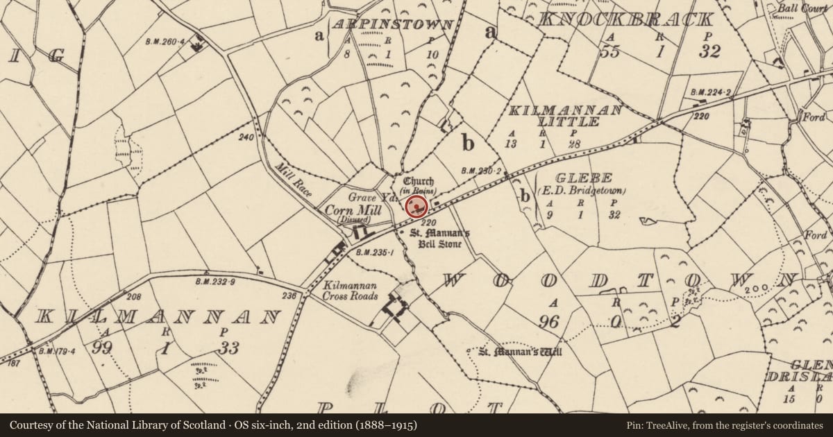
- Grave Yd.
- Coordinates
- 52.28116, -6.57712
- SMR number
- WX042-021003-
Slide toward Today to fade the historical sheet and see the modern map underneath.
University Library, Vrije Universiteit AmsterdamUniversity Library, Vrije Universiteit AmsterdamDavid Rumsey Map Collection, Stanford LibrariesDavid Rumsey Map Collection, Stanford Libraries
4 historical maps cover this location, the earliest the 1790 map "Composite: Ireland." (David Rumsey Map Collection, Stanford Libraries).
Historical maps covering this location
- 1790 · Composite: Ireland. (David Rumsey Map Collection, Stanford Libraries)
- 1891 · Ireland 16 (David Rumsey Map Collection, Stanford Libraries)
- 1904 · Sheet 14, 1904 (University Library, Vrije Universiteit Amsterdam)
- 1911 · Sheet 14, 1911 (University Library, Vrije Universiteit Amsterdam)
This record in the National Monuments Service's Historic Environment Viewer ↗
The National Monuments Service's description
Located in the valley of a small N-S stream, which is c. 20m to the W. The tower of the fortified parish church of Kilmannan (WX042-021001-) is within a rectangular graveyard (dims c. 50m E-W; c. 30m N-S) defined by masonry walls. Two small crosses (WX042-021004-; WX042-021005-) in a green stone are in the graveyard just S of the church tower as reported by Catherine McLoughlin (2020). The bullaun stone (WX042-021002-) is in a field c. 40m to the SW on the other side of an ENE-WSW public road. Archaeological testing (16E0387) c. 5-40m E of the E wall of the graveyard N-E failed to produce any related material. (McLoughlin 2016)
Compiled by: Michael Moore
Date of upload: 27 May, 2013
Amended: 9 September 2020; 23 October 2020
References
McLoughlin, C. 2020 Report on Conservation works at Kilmannon Church, Glebe, Co. Wexford. Unpublished report, Stafford McLoughlin: Archaeology/Heritage/Conservation
McLoughlin, C. 2016 Archaeological Assessment Report, Kilmannon Little and Glebe, Co. Wexford. Licence No. 16E0387. Unpublished report, Stafford McLoughlin: Archaeology/Heritage/Conservation
Nearby in the register
- Churchunder 1 mi
- Crossunder 1 mi
- Crossunder 1 mi
- Bullaun stoneunder 1 mi
Other entries of the same register within about three miles of this one, by straight line.