Sites and Monuments Record · Ireland
Concentric enclosure
Knockmullen, County Wexford, Ireland
The record
- Townland
- Knockmullen
- County
- Wexford
- Country
- Ireland
- First-edition OS map
- Not indicated
- Latest-edition OS map
- Not indicated
- Coordinates
- 52.66590, -6.28989
- SMR number
- WX012-036----
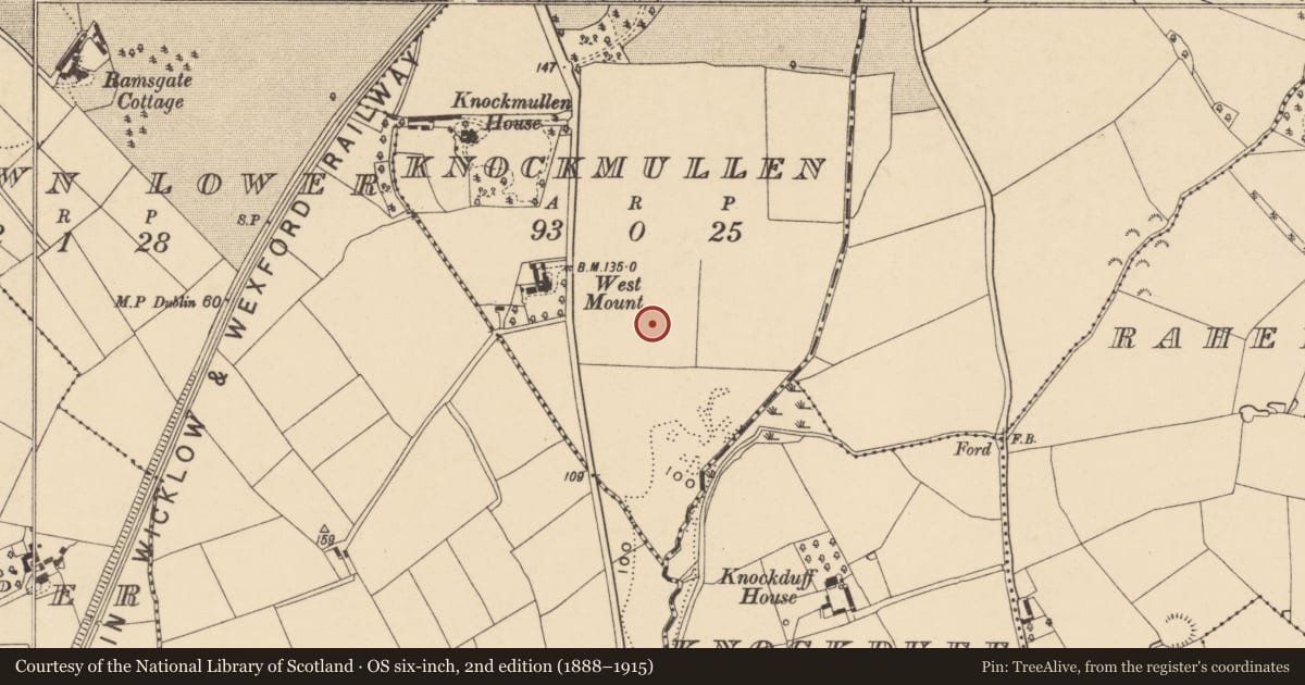
Slide toward Today to fade the historical sheet and see the modern map underneath.
David Rumsey Map Collection, Stanford LibrariesUniversity Library, Vrije Universiteit AmsterdamDavid Rumsey Map Collection, Stanford LibrariesDavid Rumsey Map Collection, Stanford Libraries
4 historical maps cover this location, the earliest the 1799 map "Ireland." (David Rumsey Map Collection, Stanford Libraries).
Historical maps covering this location
- 1799 · Ireland. (David Rumsey Map Collection, Stanford Libraries)
- 1811 · Ireland. (David Rumsey Map Collection, Stanford Libraries)
- 1891 · Ireland 16 (David Rumsey Map Collection, Stanford Libraries)
- 1911 · Sheet 14, 1911 (University Library, Vrije Universiteit Amsterdam)
This record in the National Monuments Service's Historic Environment Viewer ↗
The National Monuments Service's description
Located on a slight SE-facing slope. The cropmark of a circular enclosure (diam. c. 50m N-S) defined by a slight fosse or drain is visible on Google Earth (28/06/2018; 14/07/2018). It is surrounded by the fosse of an outer enclosure (diam. c. 80m N-S) that is only visible S-W-N on the same images. Archaeological testing (17E0665) by Seán Shanahan in the area immediately to the E of the central enclosure recovered a pit (diam. 0.6m; D 0.2m) with three layers including burnt clay and a charcoal-rich soil. The pit would be within the outer enclosure (Shanahan 2018, 29-31), but evidence of the outer enclosure was not found so it may have been eroded on the E side. There was little archaeology in the remainder of the area extending off to the NE (See excavations.ie 2017: 249: 2018:216).
See the attached enhanced views from Google Earth (18/06/2018) _2 and (14/07/2018) _1
Compiled by: Michael Moore
Date of upload: 28 February 2020
References
Shanahan, S. 2018 Report on Archaeological Testing Knockmullen (Phase 1), Gorey, Co. Wexford. Licence No. 17 E0665. Unpublished report, Shanarc Archaeology
Nearby in the register
- Enclosureunder 1 mi
- Ring-ditchunder 1 mi
- Burnt moundunder 1 mi
- Urn burialunder 1 mi
Other entries of the same register within about three miles of this one, by straight line.