Sites and Monuments Record · Ireland
Ecclesiastical enclosure
Clonaltra West, County Westmeath, Ireland
The record
- Townland
- Clonaltra West
- County
- Westmeath
- Country
- Ireland
- First-edition OS map
- Not indicated
- Latest-edition OS map
- Not indicated
- Coordinates
- 53.35674, -7.78466
- SMR number
- WM036-042004-
Slide toward Today to fade the historical sheet and see the modern map underneath.
David Rumsey Map Collection, Stanford LibrariesDavid Rumsey Map Collection, Stanford LibrariesDavid Rumsey Map Collection, Stanford LibrariesDavid Rumsey Map Collection, Stanford Libraries
4 historical maps cover this location, the earliest the 1790 map "Composite: Ireland." (David Rumsey Map Collection, Stanford Libraries).
Historical maps covering this location
- 1790 · Composite: Ireland. (David Rumsey Map Collection, Stanford Libraries)
- 1811 · Ireland. (David Rumsey Map Collection, Stanford Libraries)
- 1869 · Ireland. (David Rumsey Map Collection, Stanford Libraries)
- 1891 · Ireland 16 (David Rumsey Map Collection, Stanford Libraries)
This record in the National Monuments Service's Historic Environment Viewer ↗
The National Monuments Service's description
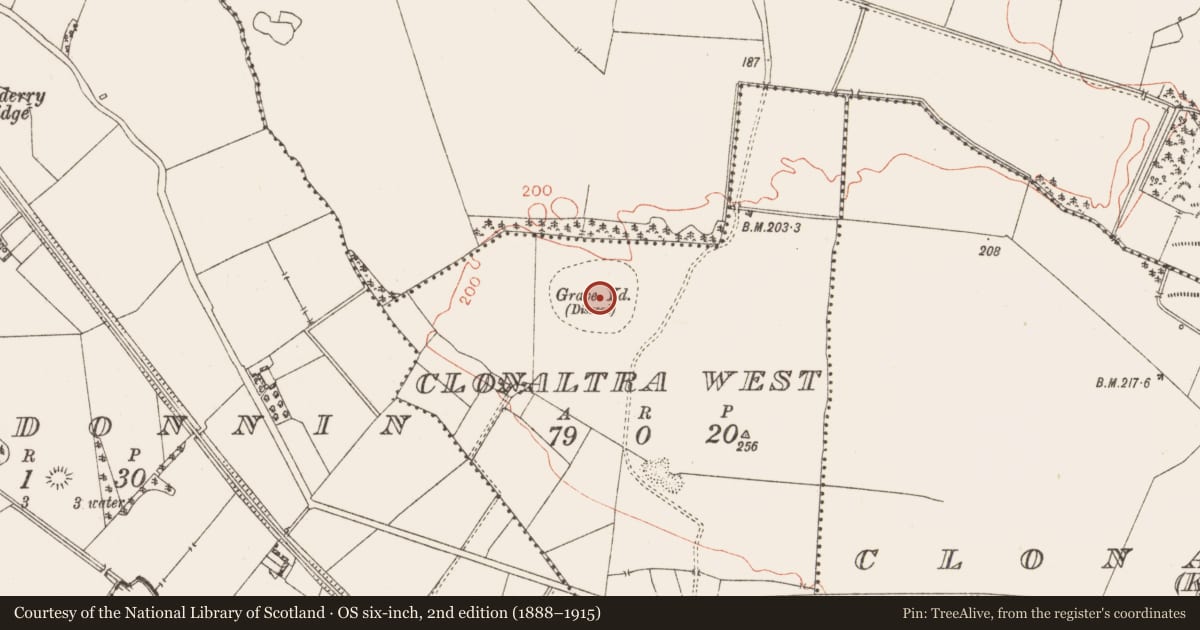
In grassland on NE facing slope of rising ground with good views to N and E. Poorly preserved remains of large roughly oval-shaped enclosure (dims. 100m N-S; 120m E-W) defined by an earthen bank mainly reduced to a scarp (H 0.6m) and outer fosse which is only visible on N side only, elsewhere it has been filled in. Depicted as a Grave Yard on the 1837 ed. OS 6-inch map. Two fragments of early Christian cross-slabs (WM036-042002-/007-) standing in group of trees containing bullaun stone (WM036-042003-) known as St. Patrick's knee stone in N quadrant of ecclesiastical enclosure. The interior of the enclosure is depicted as a graveyard (WM036-042006-) on the OS 6-inch map and local tradition records that this graveyard was also used as a children's burial ground (WM036-042008-). Site of holy well (WM036-042005-) dedicated to St. Patrick 290m to W. Large tree standing in SE quadrant of enclosure contains a some upright stones of unknown antiquity. There are the faintest traces of a smaller enclosure encircling this tree which may mark the site of the children's burial ground (WM032-042008-) (Swan 1988, 11).
Compiled by: Caimin O’Brien
Date of upload: 08 August 2014
References
Swan, D.L. 1988 The Early Christian ecclesiastical sites of County Westmeath. In J. Bradley (ed.), Settlement and society in Medieval Ireland: studies presented to F.X. Martin O.S.A., 1-31. Kilkenny. Boethius Press.
Nearby in the register
- Churchunder 1 mi
- Graveyardunder 1 mi
- Cross-slabunder 1 mi
- Bullaun stoneunder 1 mi
Other entries of the same register within about three miles of this one, by straight line.