Sites and Monuments Record · Ireland
Cross-slab
Clonaltra West, County Westmeath, Ireland
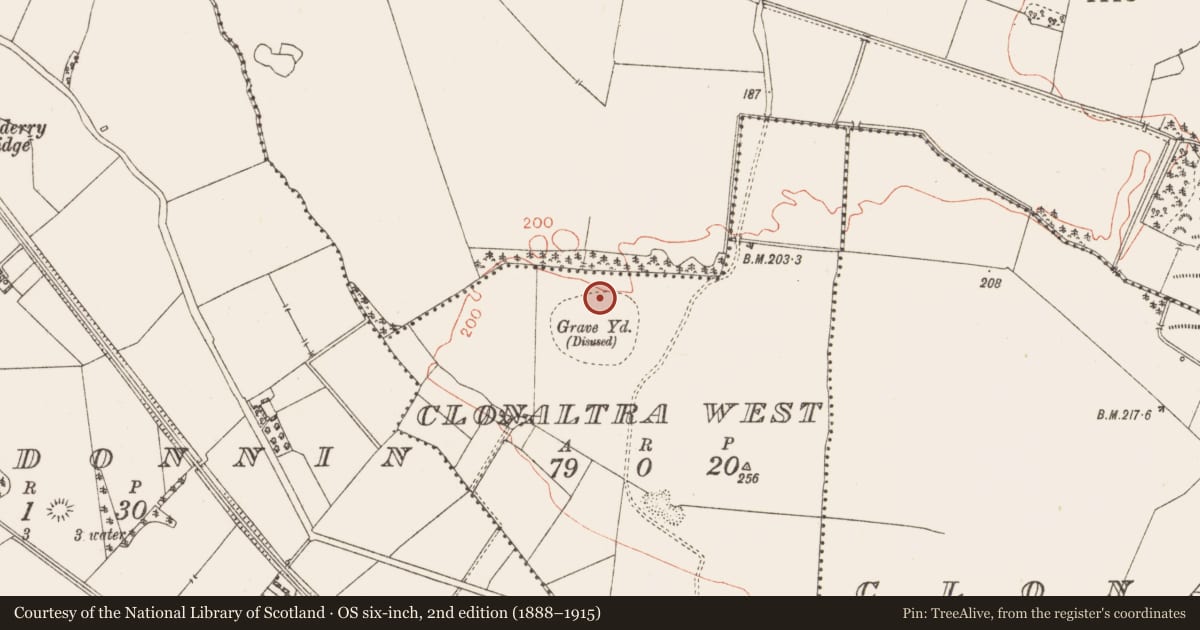
The record
- Townland
- Clonaltra West
- County
- Westmeath
- Country
- Ireland
- First-edition OS map
- Not indicated
- Latest-edition OS map
- Not indicated
- Coordinates
- 53.35715, -7.78468
- SMR number
- WM036-042002-
Slide toward Today to fade the historical sheet and see the modern map underneath.
David Rumsey Map Collection, Stanford LibrariesDavid Rumsey Map Collection, Stanford LibrariesDavid Rumsey Map Collection, Stanford LibrariesDavid Rumsey Map Collection, Stanford Libraries
4 historical maps cover this location, the earliest the 1790 map "Composite: Ireland." (David Rumsey Map Collection, Stanford Libraries).
Historical maps covering this location
- 1790 · Composite: Ireland. (David Rumsey Map Collection, Stanford Libraries)
- 1811 · Ireland. (David Rumsey Map Collection, Stanford Libraries)
- 1869 · Ireland. (David Rumsey Map Collection, Stanford Libraries)
- 1891 · Ireland 16 (David Rumsey Map Collection, Stanford Libraries)
This record in the National Monuments Service's Historic Environment Viewer ↗
The National Monuments Service's description
Fragment of early Christian cross-slab standing in group of trees containing bullaun stone and fragment of a second cross-slab (WM036-042007-) in N quadrant of ecclesiastical enclosure (WM036-042004-) at Clonaltra West. The interior of the enclosure is depicted as a graveyard (WM036-042006-) on the OS 6-inch map and local tradition records that this graveyard was also used as a children's burial ground (WM036-042008-). Site of holy well (WM036-042005-) 290m to W. Fragment consists of the lower portion of a slab (H 0.4m x Wth 0.42m x T 0.05m) decorated with a ringed-cross lying at the base of a bullaun stone. The lower portion of the slab contains the outline of a cross-shaft with a ringed cross rising from the top of the shaft. A small stud is depicted at the junction between the shaft and cross-head. The top half of the ringed cross is missing. Described in 1974 as a ‘yellowish sandstone slab found leaning against a double bullaun’ and consisting of an ‘inscribed slab, roughly shield-shaped, bears what appears to be the bottom portion of a ringed cross in low relief, with the arms and upper two-thirds of the ring broken off’ (Hicks 1974, 158). According to Hicks there was ‘a small standing stone or gravestone with no observable markings, almost buried beneath a heap of smaller stones in the south-eastern quarter of the site’ (ibid.). Today a large tree marks the site of this orthostat which is incorporated into the trunk of the tree.
Compiled by: Caimin O’Brien
Date of upload: 08 August 2014
References
Hicks, R. 1974 Two cross-inscribed stones. Journal of the Royal Society of Antiquaries of Ireland 104, 157-58.
Nearby in the register
- Bullaun stoneunder 1 mi
- Cross-slabunder 1 mi
- Churchunder 1 mi
- Ecclesiastical enclosureunder 1 mi
Other entries of the same register within about three miles of this one, by straight line.