Sites and Monuments Record · Ireland
Church
Balrath (Moycashel By.), County Westmeath, Ireland
The record
- Townland
- Balrath (Moycashel By.)
- County
- Westmeath
- Country
- Ireland
- First-edition OS map
- Outlined
- Latest-edition OS map
- Not indicated
- Coordinates
- 53.40314, -7.48346
- SMR number
- WM032-102001-
Slide toward Today to fade the historical sheet and see the modern map underneath.
David Rumsey Map Collection, Stanford LibrariesDavid Rumsey Map Collection, Stanford LibrariesDavid Rumsey Map Collection, Stanford LibrariesDavid Rumsey Map Collection, Stanford Libraries
4 historical maps cover this location, the earliest the 1790 map "Composite: Ireland." (David Rumsey Map Collection, Stanford Libraries).
Historical maps covering this location
- 1790 · Composite: Ireland. (David Rumsey Map Collection, Stanford Libraries)
- 1811 · Ireland. (David Rumsey Map Collection, Stanford Libraries)
- 1869 · Ireland. (David Rumsey Map Collection, Stanford Libraries)
- 1891 · Ireland 16 (David Rumsey Map Collection, Stanford Libraries)
This record in the National Monuments Service's Historic Environment Viewer ↗
The National Monuments Service's description
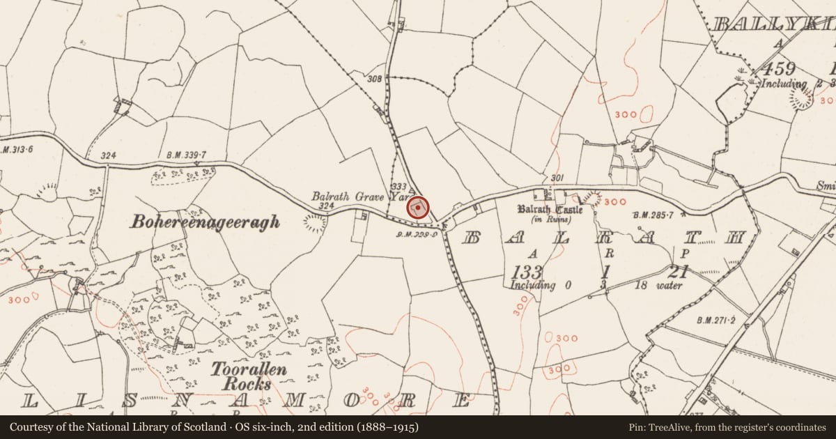
Situated on the E end of a ridge, with extensive views in all directions. Balrath Castle (WM032-103001-) 320m to the E. Forming the N end of Balrath graveyard (WM032-102----) are the wall footings of a rectangular structure aligned E-W which possibly represents the remains of a church. Only a short section of the central part of the S wall (L 2.2m; H 2.5m; T 0.85m) of the church survives upstanding and is featureless. The wall built of coursed rubble measures 0.85m thick suggesting a pre-1700 date for this building. There was no visible remains of the wall footings of the E or W walls of this structure. The N and S walls of this possible church are depicted on the 1837 ed. OS 6-inch map. On this map the two walls are not depicted as a building. It has been suggested that these walls represent the remains of a private burial area instead of a pre-1700 church (SMR file). No church is depicted standing inside this graveyard on any edition of the OS 6-inch maps. According to local information this building is known locally as Balrath Church.
Compiled by: Caimin O’Brien
Date of upload: 3 October 2017
Nearby in the register
- Graveyardunder 1 mi
- Ringfort - cashelunder 1 mi
- Castle - unclassifiedunder 1 mi
- Enclosureunder 1 mi
Other entries of the same register within about three miles of this one, by straight line.