Sites and Monuments Record · Ireland
Ringfort - rath
Ballyhast, County Westmeath, Ireland
The record
- Townland
- Ballyhast
- County
- Westmeath
- Country
- Ireland
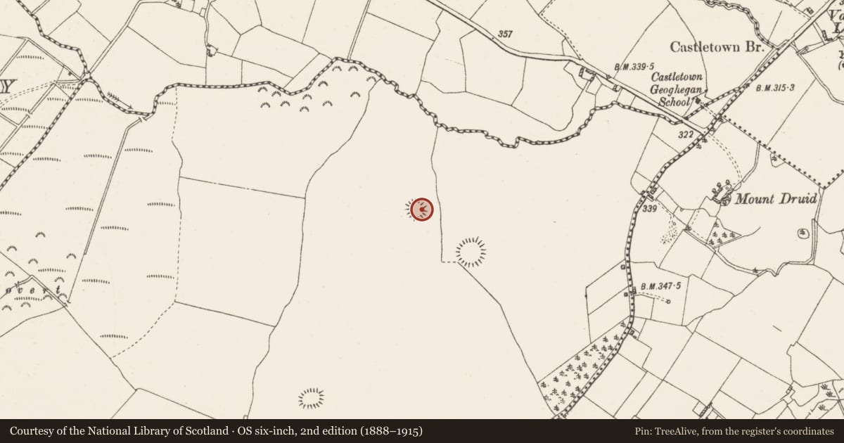
- First-edition OS map
- Hachured
- Latest-edition OS map
- Hachured
- Coordinates
- 53.44222, -7.50467
- SMR number
- WM032-009----
Slide toward Today to fade the historical sheet and see the modern map underneath.
David Rumsey Map Collection, Stanford LibrariesDavid Rumsey Map Collection, Stanford LibrariesDavid Rumsey Map Collection, Stanford LibrariesDavid Rumsey Map Collection, Stanford Libraries
4 historical maps cover this location, the earliest the 1790 map "Composite: Ireland." (David Rumsey Map Collection, Stanford Libraries).
Historical maps covering this location
- 1790 · Composite: Ireland. (David Rumsey Map Collection, Stanford Libraries)
- 1811 · Ireland. (David Rumsey Map Collection, Stanford Libraries)
- 1869 · Ireland. (David Rumsey Map Collection, Stanford Libraries)
- 1891 · Ireland 16 (David Rumsey Map Collection, Stanford Libraries)
This record in the National Monuments Service's Historic Environment Viewer ↗
The National Monuments Service's description
Monument surveyed by ASI in 1979 and described as following; 'The small circular area (diam. 27.5m N-S; 24.5m E-W) is delimited by a boulder type bank which is best preserved on the WNW. This is surrounded by a shallow fosse best seen on the N and S where it cuts through the small ridge on which the site is placed. There are traces of a counterscarp bank at these points and a very vague hint of an outer bank of stone and earth might have been present. There is some indication of an entrance feature in the NW but it may be late. The interior is fairly level but there is a modern quarry depression in the NE corner. In the E a line of large boulder type stones extends into the interior from the bank and they appear to be set. There are also some large stones on the bank in the N sector which may be connected and they are also a late feature. The site was planted. Situated in rather good grazing land with good views' (SMR File 28/06/1979).
Compiled by: Caimin O'Brien
Date of upload: 12 February 2013
Nearby in the register
- Ringfort - rathunder 1 mi
- Ringfort - rathunder 1 mi
- Ringfort - rathunder 1 mi
- Graveyardunder 1 mi
Other entries of the same register within about three miles of this one, by straight line.