Sites and Monuments Record · Ireland
Ringfort - rath
Killachonna (Clibborn), County Westmeath, Ireland
The record
- Townland
- Killachonna (Clibborn)
- County
- Westmeath
- Country
- Ireland
- First-edition OS map
- Hachured
- Latest-edition OS map
- Hachured
- Coordinates
- 53.40838, -7.74841
- SMR number
- WM030-082----
Slide toward Today to fade the historical sheet and see the modern map underneath.
David Rumsey Map Collection, Stanford LibrariesDavid Rumsey Map Collection, Stanford LibrariesDavid Rumsey Map Collection, Stanford LibrariesDavid Rumsey Map Collection, Stanford Libraries
4 historical maps cover this location, the earliest the 1790 map "Composite: Ireland." (David Rumsey Map Collection, Stanford Libraries).
Historical maps covering this location
- 1790 · Composite: Ireland. (David Rumsey Map Collection, Stanford Libraries)
- 1811 · Ireland. (David Rumsey Map Collection, Stanford Libraries)
- 1869 · Ireland. (David Rumsey Map Collection, Stanford Libraries)
- 1891 · Ireland 16 (David Rumsey Map Collection, Stanford Libraries)
This record in the National Monuments Service's Historic Environment Viewer ↗
The National Monuments Service's description
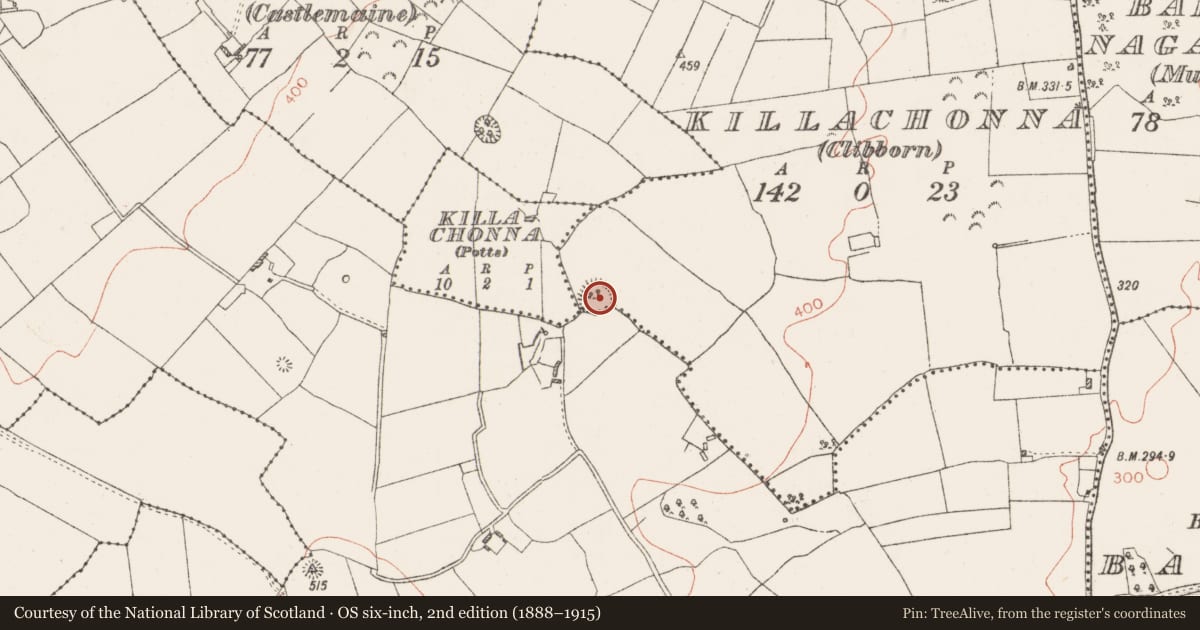
Situated on a small rise, on a S-facing slope, just below the summit of a large ridge, in pasture, with good views to S and W. Depicted on the revised 1910 ed. OS 25-inch map as a suboval-shaped earthwork abutting a townland boundary to S and W. Monument described as an oval-shaped area (dims. 34m N-S; 32m E-W) enclosed by a bank and external fosse. The bank is low and is best preserved from E-S and is almost reduced to a scarp from S-W-N-E. The fosse is best preserved from SE-S-W where it appears to have been re-cut as a drain associated with a townland boundary which runs along the outer edge of the fosse around this arc. The fosse is faint elsewhere from W-N-E-SE. There are no indications of an entrance. The interior has a W-facing slope and is scattered with stones which appear to derive from field clearance. There is a possible house site (WM030-082001-) in the S quadrant. Monument is visible today as a tree-planted earthwork on Digital Globe aerial photography.
Compiled by Alison McQueen, Vera Rahilly and Caimin O’Brien.
Date of upload: 09 November 2019
Nearby in the register
- House - indeterminate dateunder 1 mi
- Ringfort - rathunder 1 mi
- Moundunder 1 mi
- Earthworkunder 1 mi
Other entries of the same register within about three miles of this one, by straight line.