Sites and Monuments Record · Ireland
Ringfort - rath
Killeenbrack, County Westmeath, Ireland
The record
- Townland
- Killeenbrack
- County
- Westmeath
- Country
- Ireland
- First-edition OS map
- Hachured
- Latest-edition OS map
- Hachured
- Coordinates
- 53.47332, -7.58969
- SMR number
- WM024-099----
Slide toward Today to fade the historical sheet and see the modern map underneath.
David Rumsey Map Collection, Stanford LibrariesDavid Rumsey Map Collection, Stanford LibrariesDavid Rumsey Map Collection, Stanford LibrariesDavid Rumsey Map Collection, Stanford Libraries
4 historical maps cover this location, the earliest the 1790 map "Composite: Ireland." (David Rumsey Map Collection, Stanford Libraries).
Historical maps covering this location
- 1790 · Composite: Ireland. (David Rumsey Map Collection, Stanford Libraries)
- 1811 · Ireland. (David Rumsey Map Collection, Stanford Libraries)
- 1869 · Ireland. (David Rumsey Map Collection, Stanford Libraries)
- 1891 · Ireland 16 (David Rumsey Map Collection, Stanford Libraries)
This record in the National Monuments Service's Historic Environment Viewer ↗
The National Monuments Service's description
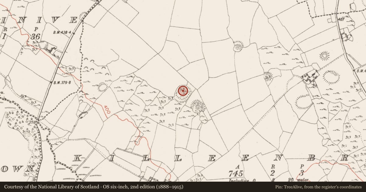
Situated on a rise, in pasture, with good views in all directions. Ringfort (WM024-100----) lies c. 30m to SE. Monument described as a large subcircular-shaped area enclosed by an earth and stone bank, a wide deep fosse and an outer bank that is incorporated into a field boundary from W-N and has drystone masonry facing along its interior. A bank on the exterior of the outer bank at S may be part of an old field system. There is a well-defined entrance in the inner bank (Wth at top 4.8m; basal Wth 2.4m) and outer bank at SE. There is a causeway (overall Wth 6.9m; Wth at top 4.1m; H 1m) at SE and a low bank (overall Wth 0.8m; Wth at top 0.4m; H 0.25m) defines the NE side of the causeway. The interior has a NW-facing slope and contains a complex of house sites and enclosures (WM024-099001-), low dividing banks and depressions. A Preservation Order was placed on this monument on 04/05/1984 (SMR file).
See attached plan and profile of monument surveyed and drawn by the ASI.
Compiled by Alison McQueen, Vera Rahilly and Caimin O’Brien.
Date of upload: 21 August 2019
Nearby in the register
- Hut siteunder 1 mi
- Ringfort - rathunder 1 mi
- House - indeterminate dateunder 1 mi
- Cistunder 1 mi
Other entries of the same register within about three miles of this one, by straight line.