Sites and Monuments Record · Ireland
Designed landscape - tree-ring
Curristown Or Bellmount, County Westmeath, Ireland
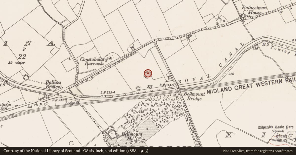
The record
- Townland
- Curristown Or Bellmount
- County
- Westmeath
- Country
- Ireland
- First-edition OS map
- Outlined
- Latest-edition OS map
- Hachured
- Coordinates
- 53.50899, -7.40806
- SMR number
- WM018-145----
Slide toward Today to fade the historical sheet and see the modern map underneath.
David Rumsey Map Collection, Stanford LibrariesDavid Rumsey Map Collection, Stanford LibrariesDavid Rumsey Map Collection, Stanford LibrariesDavid Rumsey Map Collection, Stanford Libraries
4 historical maps cover this location, the earliest the 1790 map "Composite: Ireland." (David Rumsey Map Collection, Stanford Libraries).
Historical maps covering this location
- 1790 · Composite: Ireland. (David Rumsey Map Collection, Stanford Libraries)
- 1811 · Ireland. (David Rumsey Map Collection, Stanford Libraries)
- 1869 · Ireland. (David Rumsey Map Collection, Stanford Libraries)
- 1891 · Ireland 16 (David Rumsey Map Collection, Stanford Libraries)
This record in the National Monuments Service's Historic Environment Viewer ↗
The National Monuments Service's description
Situated in gently undulating and hummocky pasture. A possible mound (WM018-147----) lies c. 67m to SW. Depicted on the 1837 ed. OS 6-inch map as the outline of a roughly circular-shaped tree-ring. Depicted on the revised 1913 ed. OS 25-inch map as a roughly circular-shaped earthwork.
Monument described as a circular-shaped, round-topped hillock (diam. 27m) enclosed at the base by a relatively modern-looking bank, which resembles a scarp in places and has the remains of a slight external fosse-like feature. A steep-sided gap (Wth at top 3.6m; basal Wth 2m) at NE may represent the entrance. A large portion of the hillock has been quarried at W. A modern field fence contacts the scarp at E. The site may be a tree-ring on the estate of Belmont House which lies c. 365m to SW. Monument is visible as a subcircular-shaped earthwork on Digital Globe aerial photography.
Compiled by: Alison McQueen, Vera Rahilly and Caimin O’Brien
Date of upload: 12 February 2019
Nearby in the register
- Barrow - unclassifiedunder 1 mi
- Earthworkunder 1 mi
- Rabbit warrenunder 1 mi
- House - indeterminate dateunder 1 mi
Other entries of the same register within about three miles of this one, by straight line.