Sites and Monuments Record · Ireland
Enclosure - large enclosure
Kilpatrick (Rathconrath By.), County Westmeath, Ireland
The record
- Townland
- Kilpatrick (Rathconrath By.)
- County
- Westmeath
- Country
- Ireland
- First-edition OS map
- Partially hachured
- Latest-edition OS map
- Not indicated
- Coordinates
- 53.54214, -7.50645
- SMR number
- WM018-056----
Slide toward Today to fade the historical sheet and see the modern map underneath.
David Rumsey Map Collection, Stanford LibrariesDavid Rumsey Map Collection, Stanford LibrariesDavid Rumsey Map Collection, Stanford LibrariesDavid Rumsey Map Collection, Stanford Libraries
4 historical maps cover this location, the earliest the 1790 map "Composite: Ireland." (David Rumsey Map Collection, Stanford Libraries).
Historical maps covering this location
- 1790 · Composite: Ireland. (David Rumsey Map Collection, Stanford Libraries)
- 1811 · Ireland. (David Rumsey Map Collection, Stanford Libraries)
- 1869 · Ireland. (David Rumsey Map Collection, Stanford Libraries)
- 1891 · Ireland 16 (David Rumsey Map Collection, Stanford Libraries)
This record in the National Monuments Service's Historic Environment Viewer ↗
The National Monuments Service's description
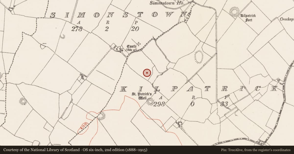
Situated in level pasture. St. Patrick's Well (WM018-059----) lies c. 135m to SE, a ringfort (WM018-058----) lies c. 150m to S and castle site (WM018-042----) c. 160m to NW. Depicted on the 1837 ed. OS 6-inch map as a partial D-shaped earthwork with curvilinear bank (C 68m) visible from NE-SE and by a bank (L 70m) along the straight side to SW. The D-shaped area has been incorporated into a field boundary on the 1913 ed. OS 25-inch map. Monument is described in 1983 as no surface remains visible however the monument is clearly visible on Digital Globe aerial photographs. Visible on aerial photographs as a partial D-shaped earthwork defined by a curvilinear, partially tree-lined field boundary with an outer fosse visible from NE-SE. Straight side of monument is defined by a linear field boundary running NW-SE along the SW side.
Compiled by: Alison McQueen, Vera Rahilly and Caimin O’Brien
Date of upload: 04 February 2019
Nearby in the register
- Ritual site - holy wellunder 1 mi
- Ringfort - rathunder 1 mi
- Castle - unclassifiedunder 1 mi
- Enclosureunder 1 mi
Other entries of the same register within about three miles of this one, by straight line.