Sites and Monuments Record · Ireland
Church
Relick (Longworth), County Westmeath, Ireland
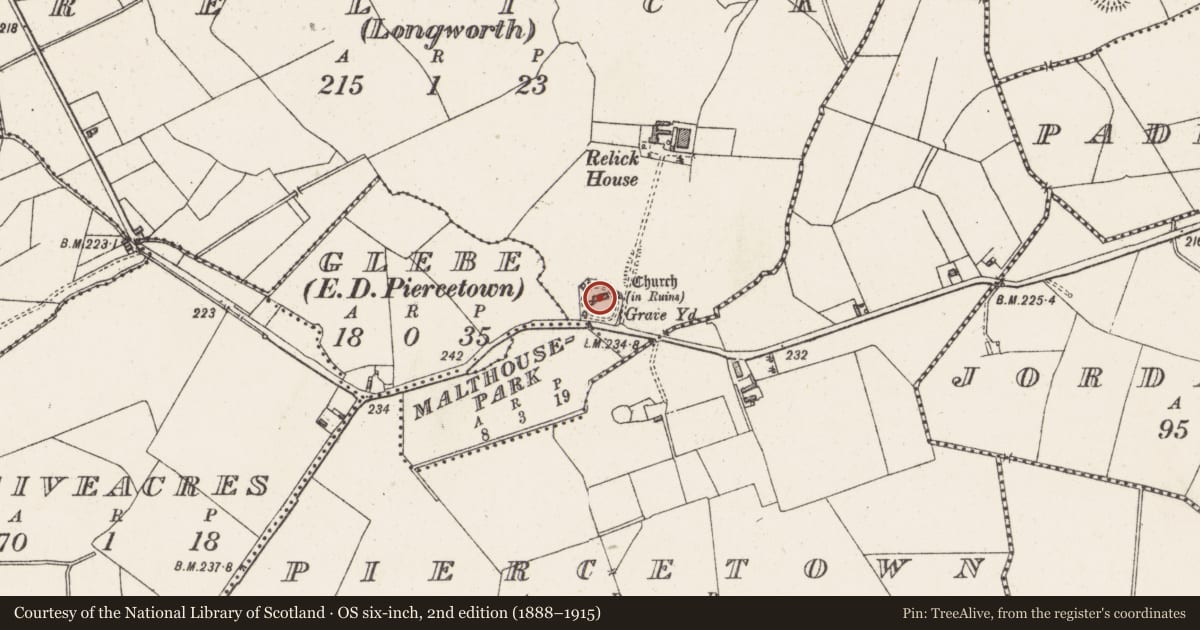
The record
- Townland
- Relick (Longworth)
- County
- Westmeath
- Country
- Ireland
- First-edition OS map
- Church
- Latest-edition OS map
- Church (in Ruins)
- Coordinates
- 53.56052, -7.60421
- SMR number
- WM017-005----
Slide toward Today to fade the historical sheet and see the modern map underneath.
David Rumsey Map Collection, Stanford LibrariesDavid Rumsey Map Collection, Stanford LibrariesDavid Rumsey Map Collection, Stanford LibrariesDavid Rumsey Map Collection, Stanford Libraries
4 historical maps cover this location, the earliest the 1790 map "Composite: Ireland." (David Rumsey Map Collection, Stanford Libraries).
Historical maps covering this location
- 1790 · Composite: Ireland. (David Rumsey Map Collection, Stanford Libraries)
- 1811 · Ireland. (David Rumsey Map Collection, Stanford Libraries)
- 1869 · Ireland. (David Rumsey Map Collection, Stanford Libraries)
- 1891 · Ireland 16 (David Rumsey Map Collection, Stanford Libraries)
This record in the National Monuments Service's Historic Environment Viewer ↗
The National Monuments Service's description
Depicted on the 1837 ed. OS 6-inch map as a rectangular church standing in the centre of a rectangular shaped graveyard (WM017-005003-). The rectangular-shaped graveyard is enclosed by a post-1700 wall with remains of a relatively modern church standing in the centre of the graveyard. The graveyard contains many relatively modern tombstones. Immediately inside the graveyard wall there are the remains of a curving earthen bank which forms a circular enclosure around the church and may be the remains of an Early Christian ecclesiastical enclosure (WM017-005001-). The only other possibly early feature is a crossslab (WM017-005002-).
The terrier of the 1654-7 Down Survey map of Piercetowne parish recorded that 'on Relicke stands the ruins of a church' (NLI, MS 723-4).
Compiled by: Frank Coyne and Caimin O'Brien
Date of upload: 13 February 2018
References
NLI, MS 723-4 - National Library of Ireland, The parish maps of the Down Survey for the County of Westmeath, attested by W. Petty, in 1659. Copied by Daniel O'Brien. A set of 67 maps with accompanying terriers in two volumes, 1786-7. Dublin.
Nearby in the register
- Ecclesiastical enclosureunder 1 mi
- Cross-slabunder 1 mi
- Graveyardunder 1 mi
- Ringfort - rathunder 1 mi
Other entries of the same register within about three miles of this one, by straight line.