Sites and Monuments Record · Ireland
Ecclesiastical enclosure
Noughaval, County Westmeath, Ireland
The record
- Townland
- Noughaval
- County
- Westmeath
- Country
- Ireland
- First-edition OS map
- Not indicated
- Latest-edition OS map
- Not indicated
- Coordinates
- 53.52427, -7.77854
- SMR number
- WM016-012003-
Slide toward Today to fade the historical sheet and see the modern map underneath.
David Rumsey Map Collection, Stanford LibrariesDavid Rumsey Map Collection, Stanford LibrariesDavid Rumsey Map Collection, Stanford LibrariesDavid Rumsey Map Collection, Stanford Libraries
4 historical maps cover this location, the earliest the 1790 map "Composite: Ireland." (David Rumsey Map Collection, Stanford Libraries).
Historical maps covering this location
- 1790 · Composite: Ireland. (David Rumsey Map Collection, Stanford Libraries)
- 1811 · Ireland. (David Rumsey Map Collection, Stanford Libraries)
- 1869 · Ireland. (David Rumsey Map Collection, Stanford Libraries)
- 1891 · Ireland 16 (David Rumsey Map Collection, Stanford Libraries)
This record in the National Monuments Service's Historic Environment Viewer ↗
The National Monuments Service's description
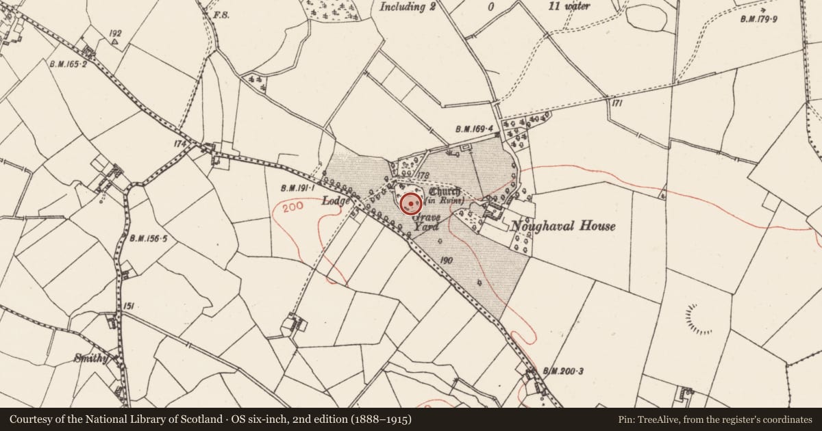
The curving sections of the D-shaped boundary wall of post-medieval date at Noughaval graveyard (WM016-012001-) may indicate the presence of an Early Christian ecclesiastical enclosure (Swan 1988, 19). Inside the curving boundary wall are the remains of a low earthen bank mainly reduced to a scarp with indications of a possible external fosse now filled in, visible running along inner face of N and E sections of graveyard wall. Medieval church ruins (WM016-012----) standing in N quadrant of Noughaval graveyard contains possible sandstone head of 12th century date. Possible holy well (WM016-012002-) associated with St Finnian located outside NW quadrant of graveyard boundary wall. A low linear earthwork in field to E of graveyard may represent remains of an old trackway running from the graveyard towards Noughaval House to the E which clearly visible on Bing Maps aerial photographs. Circular enclosure (WM016-012004-), possibly a small ring-barrow in field immediately S of boundary wall, clearly visible on OSI 2005 aerial photographs. The SMR file mentions the presence of a carved head in a shed belonging to nearby Noughaval House that was thought to be of Early Christian date. This head appears to date from the post-medieval period and may be contemporaneous with Noughaval House.
Compiled by: Caimin O'Brien
Date of upload: 1 October 2014
References
Swan, D.L. 1988 The Early Christian ecclesiastical sites of County Westmeath. In J. Bradley (ed.), Settlement and society in Medieval Ireland: studies presented to F.X. Martin O.S.A., 1-31. Kilkenny. Boethius Press.
Nearby in the register
- Graveyardunder 1 mi
- Churchunder 1 mi
- Barrow - ring-barrowunder 1 mi
- Ritual site - holy wellunder 1 mi
Other entries of the same register within about three miles of this one, by straight line.