Sites and Monuments Record · Ireland
Ringfort - rath
Monroe, County Westmeath, Ireland
The record
- Townland
- Monroe
- County
- Westmeath
- Country
- Ireland
- First-edition OS map
- Not indicated
- Latest-edition OS map
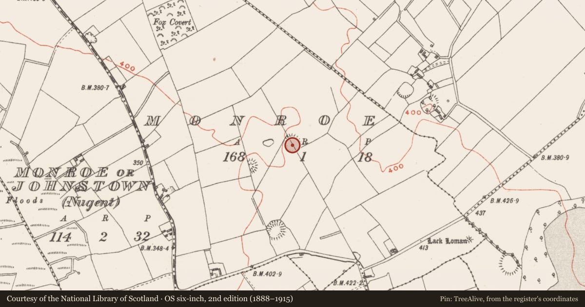
- Hachured
- Coordinates
- 53.56965, -7.42696
- SMR number
- WM011-140----
Slide toward Today to fade the historical sheet and see the modern map underneath.
David Rumsey Map Collection, Stanford LibrariesDavid Rumsey Map Collection, Stanford LibrariesDavid Rumsey Map Collection, Stanford LibrariesDavid Rumsey Map Collection, Stanford Libraries
4 historical maps cover this location, the earliest the 1790 map "Composite: Ireland." (David Rumsey Map Collection, Stanford Libraries).
Historical maps covering this location
- 1790 · Composite: Ireland. (David Rumsey Map Collection, Stanford Libraries)
- 1811 · Ireland. (David Rumsey Map Collection, Stanford Libraries)
- 1869 · Ireland. (David Rumsey Map Collection, Stanford Libraries)
- 1891 · Ireland 16 (David Rumsey Map Collection, Stanford Libraries)
This record in the National Monuments Service's Historic Environment Viewer ↗
The National Monuments Service's description
Monument placed on the Register of Historic Monuments on the 17/02/1977. Extract from Iris Oifigiúil 25th February 1977.
Situated on NW facing slope of low rise of ground surrounded by gently undulating grassland. Ringfort (WM011-141---) 320m to NNE, ringfort (WM011-138---) 200m to S, ring-barrow (WM011-137----) and stepped-barrow (WM011-159----) 100m to SW. A large sub-circular shaped area (approx. diam. 40m N-S) enclosed by two earthen banks and intervening fosse. The E half of the monument has been levelled. The inner bank is poorly preserved, the fosse is filled up at NE and the outer bank is little more than a counterscarp, levelled at E. Both banks have several disturbance gaps. The fosse seems to have been re-cut and converted into a sunken way or laneway visible from S-W only. A field boundary running NW-SE bisecs the interior of the ringfort. Post-1837 field fences intersect the perimeter of the monument at NE.
Compiled by: Frank Coyne and Caimin O'Brien
Date of upload: 29 August 2017
Nearby in the register
- Barrow - ring-barrowunder 1 mi
- Barrow - stepped barrowunder 1 mi
- Ringfort - rathunder 1 mi
- Linear earthworkunder 1 mi
Other entries of the same register within about three miles of this one, by straight line.