Sites and Monuments Record · Ireland
Ringfort - rath
Ballynafid, County Westmeath, Ireland
The record
- Townland
- Ballynafid
- County
- Westmeath
- Country
- Ireland
- First-edition OS map
- Outlined
- Latest-edition OS map
- Hachured
- Coordinates
- 53.60108, -7.39239
- SMR number
- WM011-071----
Slide toward Today to fade the historical sheet and see the modern map underneath.
David Rumsey Map Collection, Stanford LibrariesDavid Rumsey Map Collection, Stanford LibrariesDavid Rumsey Map Collection, Stanford LibrariesDavid Rumsey Map Collection, Stanford Libraries
4 historical maps cover this location, the earliest the 1790 map "Composite: Ireland." (David Rumsey Map Collection, Stanford Libraries).
Historical maps covering this location
- 1790 · Composite: Ireland. (David Rumsey Map Collection, Stanford Libraries)
- 1811 · Ireland. (David Rumsey Map Collection, Stanford Libraries)
- 1869 · Ireland. (David Rumsey Map Collection, Stanford Libraries)
- 1891 · Ireland 16 (David Rumsey Map Collection, Stanford Libraries)
This record in the National Monuments Service's Historic Environment Viewer ↗
The National Monuments Service's description
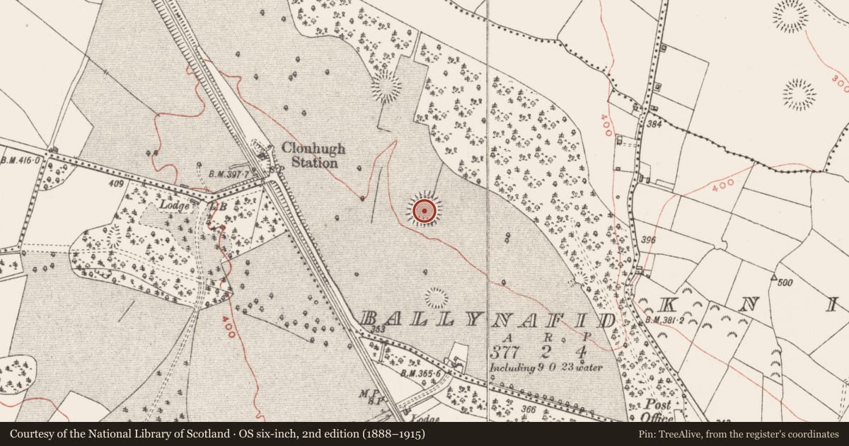
Situated on rising ground in grassland that has been planted with trees. Railway line 240m to W. Ringfort (WM011-070---) 200m to NNW. Clanhugh Demesne 270m to S with gate lodge 290m to SSE. Depicted as a tree-ring and not as an antiquity on the 1837 ed. OS 6-inch map with similar tree-ring 140m to S. Possible ringfort that was re-used as a tree-ring in the post 1700 period. Alternatively the earthwork may have been built as a tree-ring in the post 1700 period. A sub-circular shaped area (approx. diam. 46m NW-SE; 50m NE-SW) enclosed by a wide low earthen bank and external fosse. The steep sides of the fosse suggest that it has been re-dug in modern times possibly when the site was landscaped as a tree-ring. The interior slopes from NE-SW and contains spruce trees planted in the 19th century. A field fence running NNE-SSW intersects the monument at NE.
See attached profile of monument surveyed and drawn by the ASI.
Compiled by: Frank Coyne and Caimin O'Brien
Date of upload: 24 August 2017
Nearby in the register
- Ringfort - rathunder 1 mi
- Ringfort - rathunder 1 mi
- Ringfort - unclassifiedunder 1 mi
- Ringfort - rathunder 1 mi
Other entries of the same register within about three miles of this one, by straight line.