Sites and Monuments Record · Ireland
Ecclesiastical enclosure
Kiltoom, County Westmeath, Ireland
The record
- Townland
- Kiltoom
- County
- Westmeath
- Country
- Ireland
- First-edition OS map
- Not indicated
- Latest-edition OS map
- Not indicated
- Coordinates
- 53.66595, -7.34759
- SMR number
- WM007-008002-
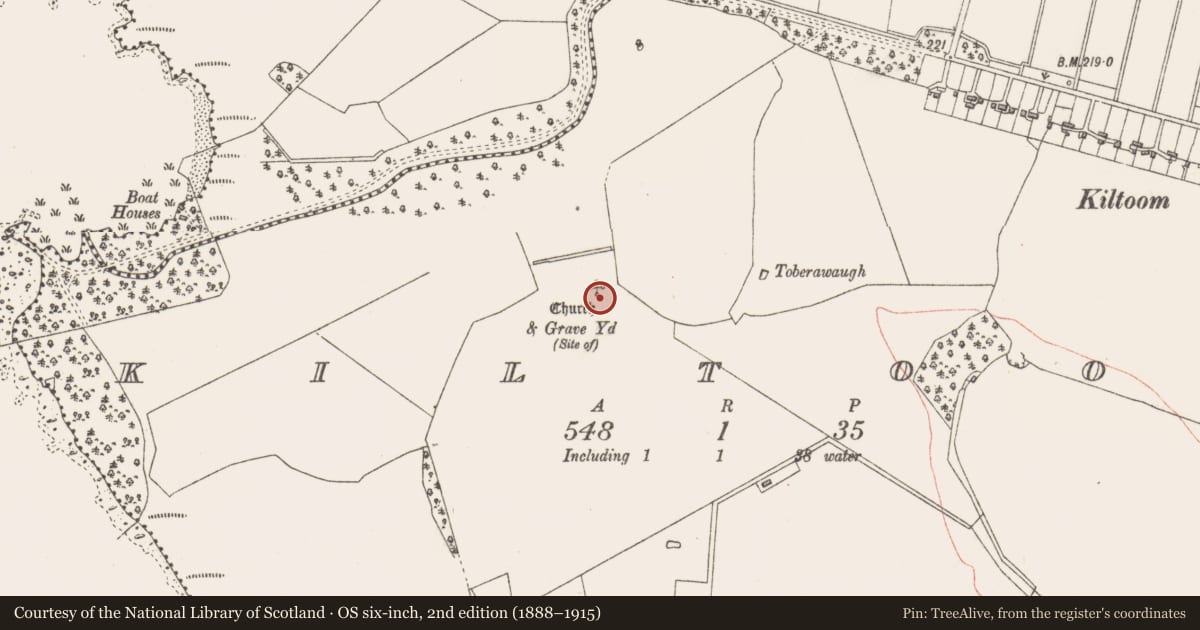
Slide toward Today to fade the historical sheet and see the modern map underneath.
David Rumsey Map Collection, Stanford LibrariesDavid Rumsey Map Collection, Stanford LibrariesDavid Rumsey Map Collection, Stanford LibrariesDavid Rumsey Map Collection, Stanford Libraries
4 historical maps cover this location, the earliest the 1790 map "Composite: Ireland." (David Rumsey Map Collection, Stanford Libraries).
Historical maps covering this location
- 1790 · Composite: Ireland. (David Rumsey Map Collection, Stanford Libraries)
- 1811 · Ireland. (David Rumsey Map Collection, Stanford Libraries)
- 1869 · Ireland. (David Rumsey Map Collection, Stanford Libraries)
- 1891 · Ireland 16 (David Rumsey Map Collection, Stanford Libraries)
This record in the National Monuments Service's Historic Environment Viewer ↗
The National Monuments Service's description
Possibly the site of the Early Christian monastery of Ceall Tóma/Tuama founded by Ninnidh Láimhiodhan of the Ceinéal Laoghaire whose feastday fell on the 13th of November (Masterson 1998, 43-4; Ó Riain 2011, 516). The curve of the field fence to the E of graveyard (WM007-008001-) possibly indicates the presence of an Early Christian ecclesiastical enclosure (Swan 1988, 21).
Present remains consist of a poorly preserved low earth and stone sub-rectangular shaped mound (approx. dims 7m E-W x 2.75m N-S; H 0.6m). There is a hint of some low earthworks to the S and E and in particular traces of a curving bank which extends away from the mound, curving SE to meet the projecting corner of the E field boundary. No surface remains visible of a church (WM007-008----) or graveyard. Cultivation ridges aligned NE-SW can be seen running across the site. Two fields to the E there is a possible holy well, marked Toberawaugh (WM007-130----).
Compiled and revised by: Caimin O’Brien
Date of revised upload: 21 February 2017
References
Ó Riain, P. 2011 A dictionary of Irish Saints. Dublin. Four Courts Press.
Swan, D.L. 1988 The Early Christian ecclesiastical sites of County Westmeath. In J. Bradley (ed.), Settlement and society in Medieval Ireland: studies presented to F.X. Martin O.S.A., 1-31. Kilkenny. Boethius Press.
Masterson, R. 1998 Some lesser-known ecclesiastical sites in Fore, Co. Westmeath. Ríocht na Midhe 9, 40-8, 43-4.
Nearby in the register
- Graveyardunder 1 mi
- Churchunder 1 mi
- Ritual site - holy wellunder 1 mi
- Barrow - ring-barrowunder 1 mi
Other entries of the same register within about three miles of this one, by straight line.