Sites and Monuments Record · Ireland
Church
Preban, County Wicklow, Ireland
The record
- Townland
- Preban
- County
- Wicklow
- Country
- Ireland
- Latest-edition OS map
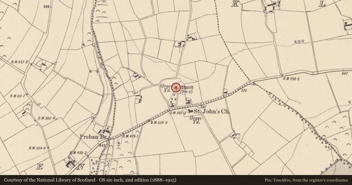
- Church (site of)
- Coordinates
- 52.83674, -6.39727
- SMR number
- WI039-011001-
Slide toward Today to fade the historical sheet and see the modern map underneath.
David Rumsey Map Collection, Stanford LibrariesDavid Rumsey Map Collection, Stanford LibrariesDavid Rumsey Map Collection, Stanford LibrariesDavid Rumsey Map Collection, Stanford Libraries
4 historical maps cover this location, the earliest the 1790 map "Composite: Ireland." (David Rumsey Map Collection, Stanford Libraries).
Historical maps covering this location
- 1790 · Composite: Ireland. (David Rumsey Map Collection, Stanford Libraries)
- 1799 · Ireland. (David Rumsey Map Collection, Stanford Libraries)
- 1811 · Ireland. (David Rumsey Map Collection, Stanford Libraries)
- 1891 · Ireland 16 (David Rumsey Map Collection, Stanford Libraries)
This record in the National Monuments Service's Historic Environment Viewer ↗
The National Monuments Service's description
Situated on level to gently SW-facing terrain. Some low stony banks which may indicate a rectangular structure (dims. c. 12m x 4m) are all that remain of the church. There is a possible entrance at the W end and slight indications of a separate chancel at the NE. Other banks at the NE indicate an attached structure. The church is located at NW side of the graveyard which is a modern five-sided enclosure (dims. c. 60m E-W; c. 50m N-S) defined by an earthen bank (Wth 3m; int. H 0.5m; ext. H 1.1m) with external drystone facing except at the S where there is a modern mortared wall. The entrance is at the SE in this wall. The graveyard contains late eighteenth and early nineteenth-century headstones. A circular enclosure (diam. c. 115m) marked around the church and graveyard on the 1838 OS 6-inch map is now delimited by a farm lane at the W and N, but is not otherwise visible at ground level.
The above description is derived from the published 'Archaeological Inventory of County Wicklow' (Dublin: Stationery Office, 1997). In certain instances the entries have been revised and updated in the light of recent research.
Compiled by: Jean Farrelly
Date of upload: 11 October 2012
Nearby in the register
- Crossunder 1 mi
- Rock artunder 1 mi
- Ecclesiastical enclosureunder 1 mi
- Graveyardunder 1 mi
Other entries of the same register within about three miles of this one, by straight line.