Sites and Monuments Record · Ireland
Megalithic structure
Parkmore (Newcastle By.), County Wicklow, Ireland
The record
- Townland
- Parkmore (Newcastle By.)
- County
- Wicklow
- Country
- Ireland
- Latest-edition OS map
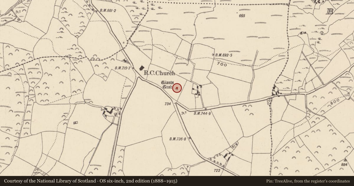
- Giants Grave
- Coordinates
- 53.00246, -6.19589
- SMR number
- WI024-007----
Slide toward Today to fade the historical sheet and see the modern map underneath.
David Rumsey Map Collection, Stanford LibrariesDavid Rumsey Map Collection, Stanford LibrariesDavid Rumsey Map Collection, Stanford LibrariesDavid Rumsey Map Collection, Stanford Libraries
4 historical maps cover this location, the earliest the 1799 map "Ireland." (David Rumsey Map Collection, Stanford Libraries).
Historical maps covering this location
- 1799 · Ireland. (David Rumsey Map Collection, Stanford Libraries)
- 1811 · Ireland. (David Rumsey Map Collection, Stanford Libraries)
- 1841 · Ireland. (David Rumsey Map Collection, Stanford Libraries)
- 1891 · Ireland 16 (David Rumsey Map Collection, Stanford Libraries)
This record in the National Monuments Service's Historic Environment Viewer ↗
The National Monuments Service's description
Situated on a gentle N-facing slope 130m NNW of a cairn (WI024-006----). Two substantial standing stones (NW stone - H 1.07m; Wth 0.6m; T 0.66m; SE stone - H 1.4m; Wth 0.9m; T 0.8m) stand 7.8m apart at either end of a mound of earth and large stones (dims. 10.3m NNW-SSE x 4m NNE-SSW; H 0.3-0.7m). (Price 1967, 510)
Described by Price (1934, 40-1) as ‘the monument in the townland of Parkmore, which is called "Giant's Grave" on the Ordnance map, consists of two pillar-stones standing 26 feet [7.9m] apart. The taller of the two is 5 feet 3 inches [1.6m] high, and its greatest width is 3 feet [0.9m]; the other stands to the W.N.W. of it, and is 4 feet 3 inches high [1.3m], and about 2 feet [0.6m] square. I know of no tradition concerning this monument’.
The above description is derived from the published 'Archaeological Inventory of County Wicklow' (Dublin: Stationery Office, 1997). In certain instances the entries have been revised and updated in the light of recent research.
Compiled by: Caimin O'Brien
Date of upload/revision: 16 November 2012
This monument is subject to a preservation order made under the National Monuments Acts 1930 to 2014 (PO no. 145/1940).
References
Price, L. 1934 The ages of stone and bronze in Co. Wicklow, Proceedings of the Royal Irish Academy 42C, 31-64.
Price, L. 1967 The place-names of Co. Wicklow. VII - The baronies of Newcastle and Arklow. The Dublin Institute of Advanced Studies (382-532).
Nearby in the register
- Cairn - unclassifiedunder 1 mi
- Enclosureunder 1 mi
- Cairn - unclassifiedunder 1 mi
- Churchunder 1 mi
Other entries of the same register within about three miles of this one, by straight line.