Sites and Monuments Record · Ireland
Cairn - unclassified
Parkmore (Newcastle By.), County Wicklow, Ireland
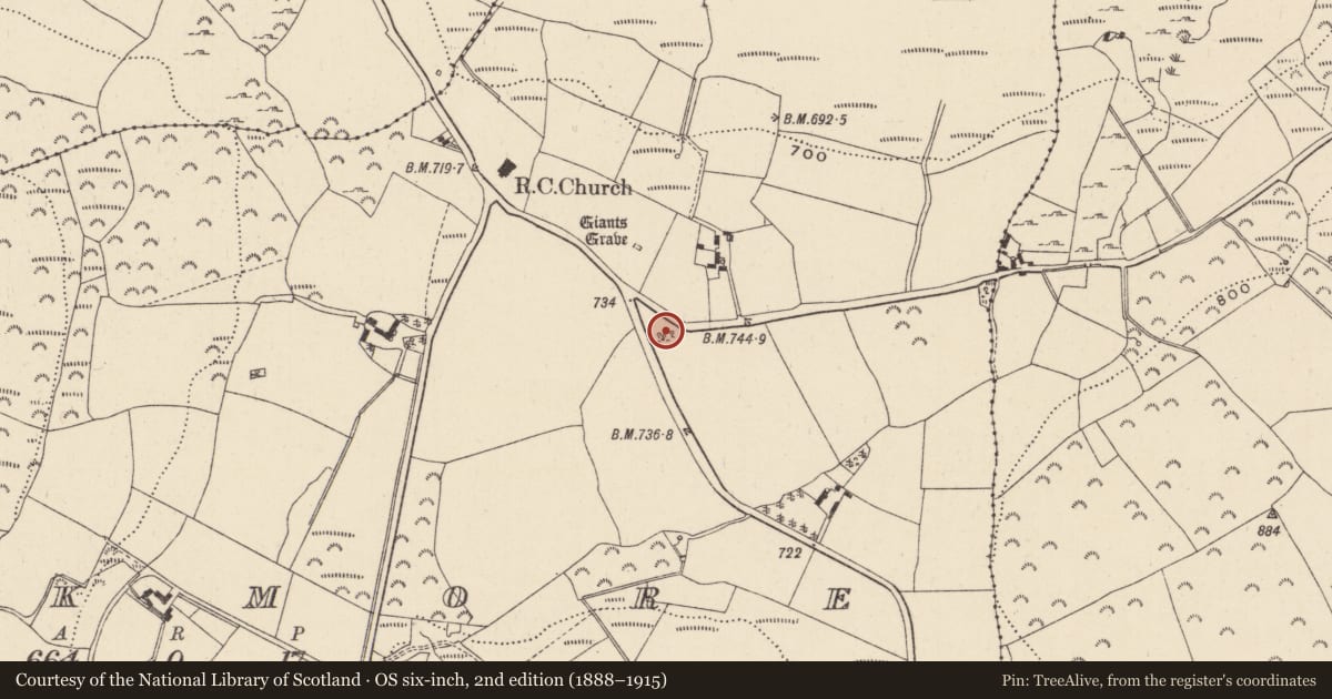
The record
- Townland
- Parkmore (Newcastle By.)
- County
- Wicklow
- Country
- Ireland
- Latest-edition OS map
- Not indicated
- Coordinates
- 53.00144, -6.19536
- SMR number
- WI024-006----
Slide toward Today to fade the historical sheet and see the modern map underneath.
David Rumsey Map Collection, Stanford LibrariesDavid Rumsey Map Collection, Stanford LibrariesDavid Rumsey Map Collection, Stanford LibrariesDavid Rumsey Map Collection, Stanford Libraries
4 historical maps cover this location, the earliest the 1799 map "Ireland." (David Rumsey Map Collection, Stanford Libraries).
Historical maps covering this location
- 1799 · Ireland. (David Rumsey Map Collection, Stanford Libraries)
- 1811 · Ireland. (David Rumsey Map Collection, Stanford Libraries)
- 1841 · Ireland. (David Rumsey Map Collection, Stanford Libraries)
- 1891 · Ireland 16 (David Rumsey Map Collection, Stanford Libraries)
This record in the National Monuments Service's Historic Environment Viewer ↗
The National Monuments Service's description
Situated in a small coniferous plantation on top of high ground in upland area with good views in all directions. Possible megalithic tomb (WI024-007----) located 130m to the NNW. Possible kerbed cairn (diam. 9m) defined by a contiguous ring of small upright boulders (H 0.3m-0.8m; Wth 0.45m) with an outer scree of loose cairn material (diam. 10.6m) and a possible central cist described by Price (1934, 52-3). Today only seven contiguous orthostats can be seen forming th kerb on the NNW side as the monument is ccovered in thorn bushes. However the remains of a central cist can be seen standing 2.5m in from the inner face of the kerb stones. This cist is formed by low upright stones (c. H 0.5m) forming a box-like structure with no capstone visible.
Described by Price (1934, 52-3) as a ’circle of stones, 30 feet [9.1m] in diameter, in the townland of Parkmore, in the corner of a field adjoining the road; the stones are small and set close together. In the centre is what looks like the remains of a central chamber consisting of 9 stones, enclosing a space about 4 feet [1.2m] long and about the same width. One of these stones is 2 feet [0.6m] above ground, and the others about 18 inches [0.45m]; there is no sign of any cap-stone. The whole space inside the circle is covered with small stones, and they extend for 2 or 3 feet [0.6m-0.9m] outside the circle; the surface is slightly higher than the level of the field. The monument has the appearance of a very much ruined cairn and burial cist. It is about 160 yards S.S.E. of the most westerly of the two pillar-stones (WI024-007----) already described. The pillar-stones are much larger than any of the stones in the circle’.
The above description is derived from the published 'Archaeological Inventory of County Wicklow' (Dublin: Stationery Office, 1997). In certain instances the entries have been revised and updated in the light of recent research.
Compiled by: Caimin O'Brien
Date of upload/revision: 16 November 2012
References
Price, L. 1934 The ages of stone and bronze in Co. Wicklow, Proceedings of the Royal Irish Academy 42C, 31-64.
Nearby in the register
- Megalithic structureunder 1 mi
- Enclosureunder 1 mi
- Cairn - unclassifiedunder 1 mi
- Churchunder 1 mi
Other entries of the same register within about three miles of this one, by straight line.