Sites and Monuments Record · Ireland
House - 16th/17th century
Killincarrig, County Wicklow, Ireland
The record
- Townland
- Killincarrig
- County
- Wicklow
- Country
- Ireland
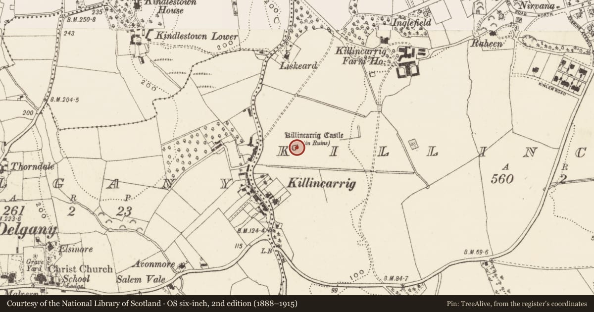
- Latest-edition OS map
- Killincarrig Castle (in Ruins)
- Coordinates
- 53.13613, -6.07762
- SMR number
- WI013-005----
Slide toward Today to fade the historical sheet and see the modern map underneath.
David Rumsey Map Collection, Stanford LibrariesDavid Rumsey Map Collection, Stanford LibrariesDavid Rumsey Map Collection, Stanford LibrariesDavid Rumsey Map Collection, Stanford Libraries
4 historical maps cover this location, the earliest the 1799 map "Ireland." (David Rumsey Map Collection, Stanford Libraries).
Historical maps covering this location
- 1799 · Ireland. (David Rumsey Map Collection, Stanford Libraries)
- 1811 · Ireland. (David Rumsey Map Collection, Stanford Libraries)
- 1841 · Ireland. (David Rumsey Map Collection, Stanford Libraries)
- 1891 · Ireland 16 (David Rumsey Map Collection, Stanford Libraries)
This record in the National Monuments Service's Historic Environment Viewer ↗
The National Monuments Service's description
Situated on a gentle E-facing slope. The remains of an early 17th-century house probably built for Henry Walsh. The main block (L 14.3m; Wth 7.6m) is gabled and had two storeys with attic. The entrance is at the E with a stair turret directly opposite projecting from the W wall. The wrought jambstones of the door were removed in 1943-4; a shallow armorial recess occurs overhead. Attached at the NE side is a kitchen block (int. dims. 6.9m x 4.9m) of similar construction and height. Substantial chimney stacks survive intact on the N and W walls of the main block. There is no cut stone visible. (Leask, OPW files 1944; Price 1957, 322)
A series of test trenches opened in 2006 (Excavation Licence 06E0113) to the WNW in advance of the construction of a dwelling did not reveal anything of archaeological significance.
The above description is derived from the published 'Archaeological Inventory of County Wicklow' (Dublin: Stationery Office, 1997). In certain instances the entries have been revised and updated in the light of recent research.
Date of revision: 14 December 2012
Revised by: Claire Breen
Nearby in the register
- Metalworking siteunder 1 mi
- Cremation pitunder 1 mi
- Kiln - corn-dryingunder 1 mi
- Fulacht fiaunder 1 mi
Other entries of the same register within about three miles of this one, by straight line.