Sites and Monuments Record · Ireland
Metalworking site
Shandon, County Waterford, Ireland
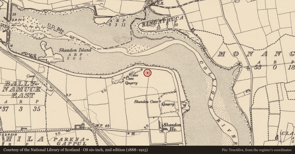
The record
- Townland
- Shandon
- County
- Waterford
- Country
- Ireland
- First-edition OS map
- Not indicated
- Latest-edition OS map
- Not indicated
- Coordinates
- 52.10121, -7.62612
- SMR number
- WA031-073----
Slide toward Today to fade the historical sheet and see the modern map underneath.
David Rumsey Map Collection, Stanford LibrariesDavid Rumsey Map Collection, Stanford LibrariesDavid Rumsey Map Collection, Stanford LibrariesDavid Rumsey Map Collection, Stanford Libraries
4 historical maps cover this location, the earliest the 1790 map "Composite: Ireland." (David Rumsey Map Collection, Stanford Libraries).
Historical maps covering this location
- 1790 · Composite: Ireland. (David Rumsey Map Collection, Stanford Libraries)
- 1882 · Ireland (southern half). (David Rumsey Map Collection, Stanford Libraries)
- 1891 · Ireland 16 (David Rumsey Map Collection, Stanford Libraries)
- 1904 · Sheet 13. (David Rumsey Map Collection, Stanford Libraries)
This record in the National Monuments Service's Historic Environment Viewer ↗
The National Monuments Service's description
Situated on relatively high ground overlooking the W-E River Colligan which is immediately to the N, at the point where it turns S before entering the sea at Dungarvan Harbour, c. 1.7km to the S. It was identified in monitoring (00E0442) by S. Elder in Area 2a and 2b of a large housing development (Elder 2002b, 5-6; 2003), and subsequently completely excavated (01E0327) by E. Dennehy (2001; 2003).
Located about 50m E of the enclosure (WA031-072----) were three areas of activity. A northern group of post-holes and pit-bottoms revealed no pattern of a strucutre. Just to the S was a small semicircular structure (int. diam. c. 2m) identified as two lines of post-holes and associated with metal-working pits, with a pit-bottom of domestic waste (diam. 1.35m; D 0.87m) just to its SE.
Dennehy, E. (2001) Report on archaeological excavations and testing at Area 2, Shandon, Dungarvan, Co. Waterford. Unpublished report. Eachtra Archaeological Projects.
Dennehy, E. (2003) Shandon, Dungarvan: Medieval rectangular earthwork and environs. in I. Bennett (Ed.) Excavations 2001: summary accounts of excavations in Ireland, 387-8, No. 1242. Wordwell. Bray.
Elder, S. (2002b) Report on archaeological monitoring of Areas 2 and 3 of a development at Shandon, Dungarvan, Co. Waterford. Unpublished report. Eachtra Archaeological Projects
Elder, S. (2003) Shandon, Dungarvan. Urban. in I. Bennett (Ed.) Excavations 2001: summary accounts of excavations in Ireland, 387, No. 1241. Wordwell. Bray
Compiled by: Michael Moore. Date of upload: 25th August, 2011.
Nearby in the register
- Enclosureunder 1 mi
- Churchunder 1 mi
- Burial groundunder 1 mi
- Burial groundunder 1 mi
Other entries of the same register within about three miles of this one, by straight line.