Sites and Monuments Record · Ireland
Metalworking site
Graigueshoneen, County Waterford, Ireland
The record
- Townland
- Graigueshoneen
- County
- Waterford
- Country
- Ireland
- Latest-edition OS map
- Not indicated
- Coordinates
- 52.19749, -7.42409
- SMR number
- WA015-094003-
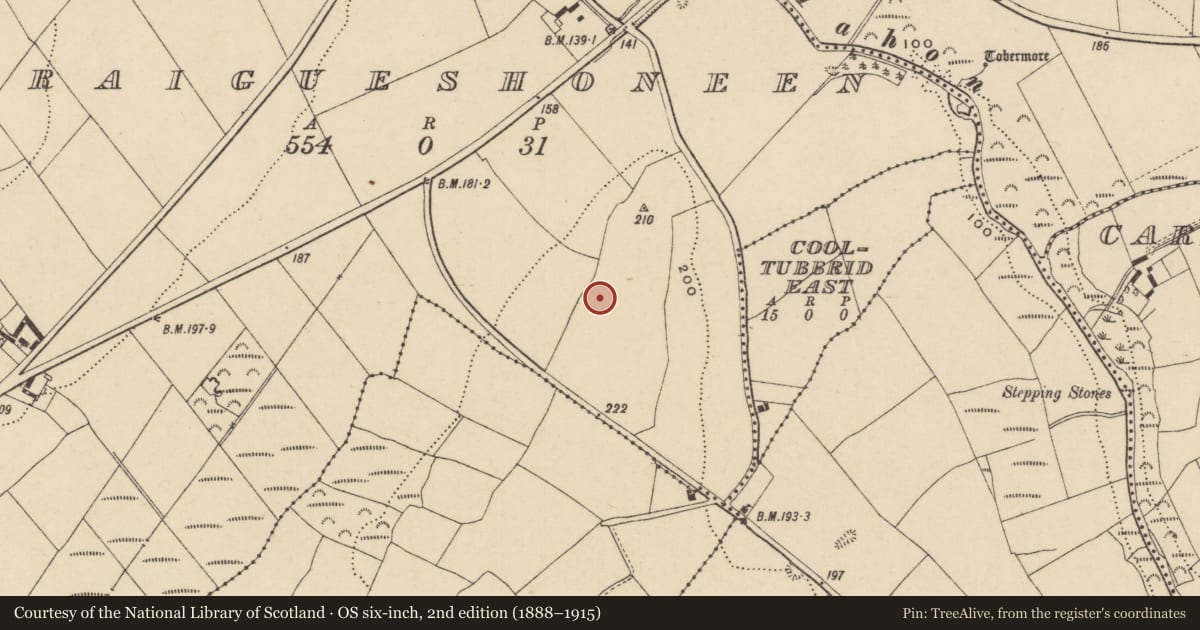
Slide toward Today to fade the historical sheet and see the modern map underneath.
David Rumsey Map Collection, Stanford LibrariesDavid Rumsey Map Collection, Stanford LibrariesDavid Rumsey Map Collection, Stanford LibrariesDavid Rumsey Map Collection, Stanford Libraries
4 historical maps cover this location, the earliest the 1790 map "Composite: Ireland." (David Rumsey Map Collection, Stanford Libraries).
Historical maps covering this location
- 1790 · Composite: Ireland. (David Rumsey Map Collection, Stanford Libraries)
- 1882 · Ireland (southern half). (David Rumsey Map Collection, Stanford Libraries)
- 1891 · Ireland 16 (David Rumsey Map Collection, Stanford Libraries)
- 1904 · Sheet 13. (David Rumsey Map Collection, Stanford Libraries)
This record in the National Monuments Service's Historic Environment Viewer ↗
The National Monuments Service's description
Excavated (00E0059) as Area 25 of the N25 Kilmacthomas re-alignment. Situated at the N end of a broad S-N spur of Treacy's Hill overlooking the NW-SE Mahon river which is c. 550m to the E. It occupies the same location as Neolithic (WA015-094001-) and Bronze Age (WA015-094002-) settlement.
Two bowl-furnaces were revealed as charcoal and slag-filled pits. One pit (dims. 1.13m x 1m; D 0.43m) had iron slag and produced a C14 determination of cal. AD 420-690. The pit had a channel at one side where the bellows may have been attached. A second furnace just 3m to the E was a pit (dims. 2.2m N-S; 1.4m E-W; D 0.48m) which produced traces of copper and a C14 determination of cal. AD 650-780. A third pit (dims. 2.2m x 1.6m; D 0.3m) just 2m to the S had no traces of burning and may have provided clay for the furnaces. (Tierney and Frazer (2002; Tierney 2008)
Compiled by: Michael Moore.
Date of upload: 17th December, 2010.
References
Tierney, J. and Frazer, W. 2002 Treacy's Hill, Graigueshoneen. Medieval. In Bennett, I. (ed.) Excavations 2000: summary accounts of archaeological excavations in Ireland, 331, No. 993. Bray. Wordwell.
Tierney, J. 2008 Early medieval iron- and copper-smelting: Area 25, Cooltubbrid East td., Licence No. 00E0059. In Johnston, P., Kiely, J. & Tierney, J. 2008 Near the bend in the River, 107-09. NRA Scheme Monographs, No. 3. Dublin.
Nearby in the register
- House - Bronze Ageunder 1 mi
- Habitation siteunder 1 mi
- Burnt moundunder 1 mi
- Burnt moundunder 1 mi
Other entries of the same register within about three miles of this one, by straight line.