Sites and Monuments Record · Ireland
Mill - unclassified
Croan Lower, County Tipperary South, Ireland
The record
- Townland
- Croan Lower
- County
- Tipperary South
- Country
- Ireland
- First-edition OS map
- Not indicated
- Latest-edition OS map
- Not indicated
- Coordinates
- 52.35331, -7.67776
- SMR number
- TS083-021001-
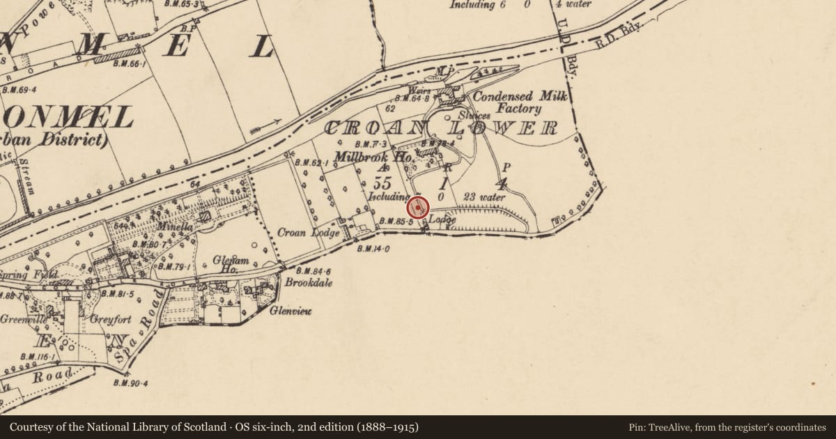
Slide toward Today to fade the historical sheet and see the modern map underneath.
David Rumsey Map Collection, Stanford LibrariesDavid Rumsey Map Collection, Stanford LibrariesDavid Rumsey Map Collection, Stanford LibrariesDavid Rumsey Map Collection, Stanford Libraries
4 historical maps cover this location, the earliest the 1790 map "Composite: Ireland." (David Rumsey Map Collection, Stanford Libraries).
Historical maps covering this location
- 1790 · Composite: Ireland. (David Rumsey Map Collection, Stanford Libraries)
- 1882 · Ireland (southern half). (David Rumsey Map Collection, Stanford Libraries)
- 1891 · Ireland 16 (David Rumsey Map Collection, Stanford Libraries)
- 1904 · Sheet 13. (David Rumsey Map Collection, Stanford Libraries)
This record in the National Monuments Service's Historic Environment Viewer ↗
The National Monuments Service's description
Less than a mile E of Clonmel, immediately S of the River Suir. According to Lyons (1942, 72-3) c. 140m SW of the mill pond there was an ‘ancient mill site’, which is indicated on a sketch plan by Lyons. He speculates that the ‘corn-mill, presumably of the Franciscans, seems to have been located as shown in the plan, as here a current to work the water-wheel was available. A ruined building at the spot seems to be a part of the mill. The lodge at the spot is quite modern, and it can be shown that there was no road here in medieval times’. Lyons suggests that the mill utilised the water channel which fed the mill ponds, which he interpreted as medieval fish-ponds (TS083-021003-). The mill race, feeding the mill pond, is shown on the 1st (1840-41) and and 1950-51 ed. OS 6-inch map. There is insufficient evidence to suggest that there was a pre-1700 mill at the location suggested by Lyons.
Compiled by: Jean Farrelly
Date of revised upload: 20 January 2015
Nearby in the register
- Standing stoneunder 1 mi
- Weir - regulatingunder 1 mi
- House - 18th/19th centuryunder 1 mi
- Spa works/bathunder 1 mi
Other entries of the same register within about three miles of this one, by straight line.