Sites and Monuments Record · Ireland
Ringfort - rath
Farranshea, County Tipperary South, Ireland
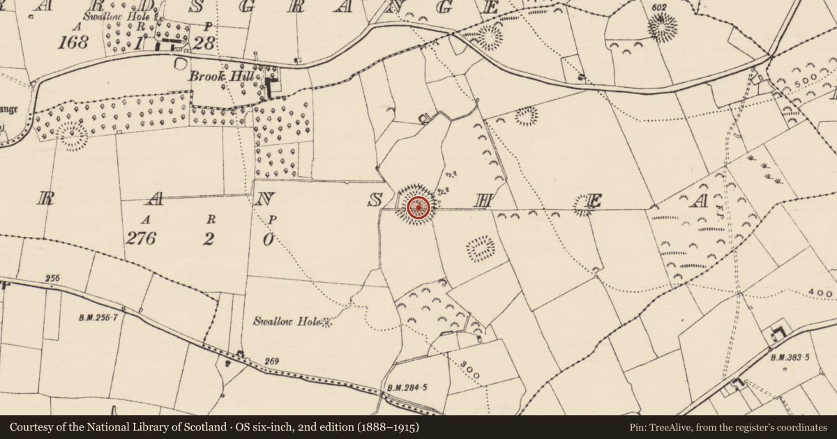
The record
- Townland
- Farranshea
- County
- Tipperary South
- Country
- Ireland
- First-edition OS map
- Hachured
- Latest-edition OS map
- Hachured
- Coordinates
- 52.47310, -7.66031
- SMR number
- TS070-018----
Slide toward Today to fade the historical sheet and see the modern map underneath.
David Rumsey Map Collection, Stanford LibrariesDavid Rumsey Map Collection, Stanford LibrariesDavid Rumsey Map Collection, Stanford LibrariesDavid Rumsey Map Collection, Stanford Libraries
4 historical maps cover this location, the earliest the 1790 map "Composite: Ireland." (David Rumsey Map Collection, Stanford Libraries).
Historical maps covering this location
- 1790 · Composite: Ireland. (David Rumsey Map Collection, Stanford Libraries)
- 1882 · Ireland (southern half). (David Rumsey Map Collection, Stanford Libraries)
- 1891 · Ireland 16 (David Rumsey Map Collection, Stanford Libraries)
- 1904 · Sheet 13. (David Rumsey Map Collection, Stanford Libraries)
This record in the National Monuments Service's Historic Environment Viewer ↗
The National Monuments Service's description
In woodland and pasture. Circular area, (map dims. C. 20m) defined by extant, yet not clearly visible bank (presumed to be intervening bank reduced to scarp) NW-N-ESE. Scarp (Wth 6m; ext. H 0.65m) is levelled ESE-S-WSW. Intervening fosse (Wth 10m; D 0.1m). Outer bank (Wth 14m; int. H 0.1m; ext. H 0.5m). Drain visible in place of outer bank (WSW-W-WNW). Of the southern levelled sector, not much is discernable due to low profile. Also a possible old stream path for water run-off has existed in the area of the intervening fosse between the possible outer and intervening banks. Earthen field boundary partially covered in furze bushes truncates monument E-W. There is a deeply cut drain within to N. Also deeply cut drain to E of monument therefore there was probably a problem with water and flooding in this area in previous years which would explain the sinuous water channel visible in S-area of monument. Moated site (TS070-023----) located 160m to SE.
Compiled by: Jean Farrelly
Date of upload: 26 August 2011
Nearby in the register
- Moated siteunder 1 mi
- House - 17th centuryunder 1 mi
- Enclosureunder 1 mi
- Ringfort - rathunder 1 mi
Other entries of the same register within about three miles of this one, by straight line.