Sites and Monuments Record · Ireland
Graveslab
Athasselabbey North, County Tipperary South, Ireland
The record
- Townland
- Athasselabbey North
- County
- Tipperary South
- Country
- Ireland
- First-edition OS map
- Not indicated
- Latest-edition OS map
- Not indicated
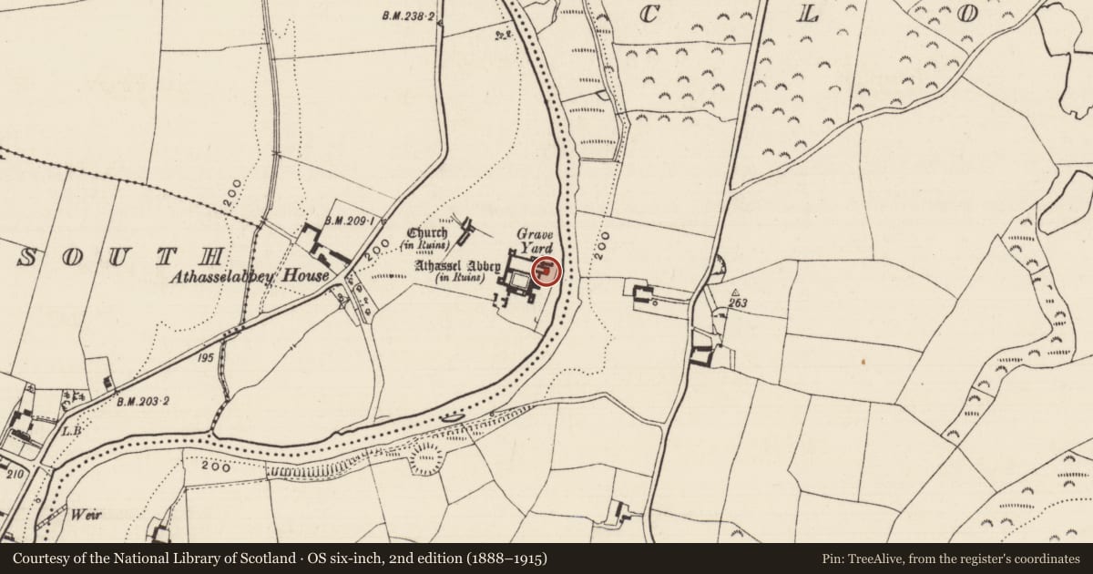
- Coordinates
- 52.47911, -7.98267
- SMR number
- TS068-013013-
Slide toward Today to fade the historical sheet and see the modern map underneath.
David Rumsey Map Collection, Stanford LibrariesDavid Rumsey Map Collection, Stanford LibrariesDavid Rumsey Map Collection, Stanford LibrariesDavid Rumsey Map Collection, Stanford Libraries
4 historical maps cover this location, the earliest the 1790 map "Composite: Ireland." (David Rumsey Map Collection, Stanford Libraries).
Historical maps covering this location
- 1790 · Composite: Ireland. (David Rumsey Map Collection, Stanford Libraries)
- 1882 · Ireland (southern half). (David Rumsey Map Collection, Stanford Libraries)
- 1891 · Ireland 16 (David Rumsey Map Collection, Stanford Libraries)
- 1904 · Sheet 13. (David Rumsey Map Collection, Stanford Libraries)
This record in the National Monuments Service's Historic Environment Viewer ↗
The National Monuments Service's description
In the chancel of the Augustinian abbey of Athassel (TS068-013----) standing against the E gable of the chancel, N of the E window. It is described by Maher (1997, 52) as a tapering slab (L 0.79m; Wth at top 0.65m; Wth at base 0.55m; average T 0.17m) with a chamfer (Wth 0.05m) along the dexter side. It is decorated with an 'ornate eight-armed cruciform motif, with each arm featuring a trefoil at its terminal and midpoint. The inner trefoils of the horizontal and vertical arms are disposed outwardly, whereas those on the diagonal arms are disposed inwardly. At the centre of the cross is an interlocked circle, composed of four segments. The diagonal arms of the overall cruciform motif emanate from the centre of the circle, while its horizontal and vertical arms also commence within the broken circle, forming a central lozenge. On both sides of the base of the design three trefoils spring in a vegetalike fashion. The inscription occurs in Lombardic lettering and commences at the top of the dexter side of the slab, running parallel to its chamfered edge. It is preceded by an equal-armed cross with expanded terminals. The lower half of the letters have been cut away as a result of the chamfering of this edge of the slab. It reads: HIC JACET (F?)RATER (I/J)OH which is probably to be interpreted as: HIC JACET FRATER JOHANNUS/JOHES (Here lies Brother John)' (ibid.).
Compiled by: Jean Farrelly
Date of upload: 11 January 2012
References
Maher, D. 1997 Medieval grave-slabs of County Tipperary, 1200-1600 A.D. BAR British Series 262.
Nearby in the register
- Tomb - effigialunder 1 mi
- Graveslabunder 1 mi
- Graveslabunder 1 mi
- Graveslabunder 1 mi
Other entries of the same register within about three miles of this one, by straight line.