Sites and Monuments Record · Ireland
Building
Kilvemnon, County Tipperary South, Ireland
The record
- Townland
- Kilvemnon
- County
- Tipperary South
- Country
- Ireland
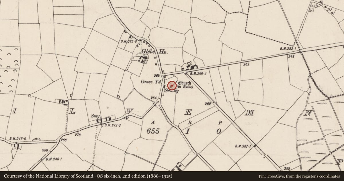
- Latest-edition OS map
- Indicated
- Coordinates
- 52.48911, -7.49551
- SMR number
- TS063-063002-
Slide toward Today to fade the historical sheet and see the modern map underneath.
David Rumsey Map Collection, Stanford LibrariesDavid Rumsey Map Collection, Stanford LibrariesDavid Rumsey Map Collection, Stanford LibrariesDavid Rumsey Map Collection, Stanford Libraries
4 historical maps cover this location, the earliest the 1790 map "Composite: Ireland." (David Rumsey Map Collection, Stanford Libraries).
Historical maps covering this location
- 1790 · Composite: Ireland. (David Rumsey Map Collection, Stanford Libraries)
- 1869 · Ireland. (David Rumsey Map Collection, Stanford Libraries)
- 1891 · Ireland 16 (David Rumsey Map Collection, Stanford Libraries)
- 1904 · Sheet 13. (David Rumsey Map Collection, Stanford Libraries)
This record in the National Monuments Service's Historic Environment Viewer ↗
The National Monuments Service's description
Within the SE angle of Kilvemnon graveyard (TS063-063003-) with the church (TS063-063001-) c. 10m to the NW. Described in the OSL (O'Flanagan 1930, vol. 1, 71 (188-9)) as 'part of a small building extending north and south, which would appear to be a lateral building belonging to the older Church. Its east gable and part of its west wall remain but present no features of any interest whatever'. This building (dims. 6.3m N-S; 4.95m E-W) is composed of limestone rubble, roughly coursed and is heavily ivy covered. It is well preserved with high gables (S gable 4.5m H; N gable 2.75m H) and side walls (W wall 2.25m H; T 0.6m; E wall less well preserved 1.18m H). It is likely to have been built as a burial vault and appears to be of late 18th or 19th century date. Within it is an altar tomb to the Rev. William Bryan and his wife, dating to 1874.
Compiled by: Jean Farrelly
Date of upload: 26 August 2011
References
O'Flanagan, Rev. M. (Compiler) 1930 Letters containing information relative to the antiquities of the county of Tipperary collected during the progress of the Ordnance Survey in 1840. Bray.
Nearby in the register
- Graveslabunder 1 mi
- Wall monumentunder 1 mi
- Graveyardunder 1 mi
- Churchunder 1 mi
Other entries of the same register within about three miles of this one, by straight line.