Sites and Monuments Record · Ireland
Deer park
St. Johnstown, County Tipperary South, Ireland
The record
- Townland
- St. Johnstown
- County
- Tipperary South
- Country
- Ireland
- First-edition OS map
- Old Deer Park
- Latest-edition OS map
- Not indicated
- Coordinates
- 52.52603, -7.65052
- SMR number
- TS062-056----
Slide toward Today to fade the historical sheet and see the modern map underneath.
David Rumsey Map Collection, Stanford LibrariesDavid Rumsey Map Collection, Stanford LibrariesDavid Rumsey Map Collection, Stanford LibrariesDavid Rumsey Map Collection, Stanford Libraries
4 historical maps cover this location, the earliest the 1790 map "Composite: Ireland." (David Rumsey Map Collection, Stanford Libraries).
Historical maps covering this location
- 1790 · Composite: Ireland. (David Rumsey Map Collection, Stanford Libraries)
- 1882 · Ireland (southern half). (David Rumsey Map Collection, Stanford Libraries)
- 1891 · Ireland 16 (David Rumsey Map Collection, Stanford Libraries)
- 1904 · Sheet 13. (David Rumsey Map Collection, Stanford Libraries)
This record in the National Monuments Service's Historic Environment Viewer ↗
The National Monuments Service's description
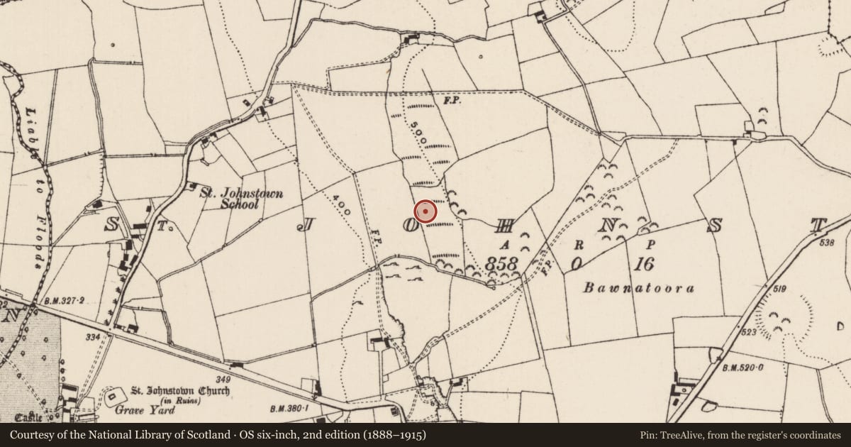
Indicated on the 1st (1840) ed. 6-inch OS map as 'Old Deer Park'. It is not clear what the extent of this deer park was or its date, though by the mid-19th century it was considered old. It is probably associated with St. Johnstown Castle, which lies c. 500m W of the possible SW angle. This consists of a medieval tower house (TS062-060001-) and a later house, named 'St. Johnstown Castle' on the 1st ed. OS map, which is described by Lewis (1837, 32) as a 'modern house' owned by James Millet. The deer park appears to consist of a roughly rectangular area c. 480m E-W x c. 640m N-S, with a triangular area, c. 390m N-S x 230m E-W extending eastward from the northern sector. Running roughly E-W through the southern portion of the rectangular area of the park is a stream, which was an essential component of a deer park. The field boundaries, indicated on the 1st ed. OS map, which may be the enclosing element of the deer park, are still extant.
Compiled by: Jean Farrelly
Date of upload: 14 October 2014
References
Lewis, S. 1837 A topographical dictionary of Ireland, 2 vols. London. Lewis and Co.
Nearby in the register
Other entries of the same register within about three miles of this one, by straight line.